Beyond measure: why — and how — communities are measuring carbon in New Brunswick
It was a foggy morning at Meenan’s Cove as we stood on the deck of a beach house overlooking the Kennebecasis River. While the fog was due to lift soon, the wind was going to pick up by the afternoon, so we had to get to work quickly. Drones, after all, depend heavily on weather, and it’s best to learn in calm conditions.
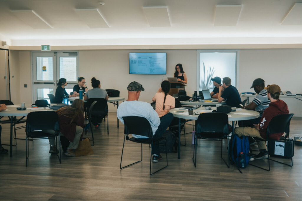
Our small WWF-Canada team was gathered here, in Quispamsis, N.B., to meet eager participants of our carbon measurement training session — one of many scheduled across the country over the next few years as we ramp up our Nature Meets Carbon project to share this training throughout Canada.

The goal? To equip communities with tools and resources to measure and monitor the carbon in the vegetation, soils and wetlands of their lands and territories. We learn in school that carbon is stored in nature through the same photosynthesis that produces oxygen, but knowing it’s there isn’t the same as knowing how much. That’s where the measuring comes in.
It also doesn’t tell us what happens when we alter, degrade, disturb or overdevelop these landscapes — by, say, draining a peatland for agriculture or a mine or greenlighting a commercial monocultural forest, or what happens depending on when (and how) we restore these ecosystems.
That’s the monitoring part, which uses the initial measurement baseline to track whether carbon is being effectively stored and sequestered into plants and soils or escaping into the atmosphere to further inflame climate change.
Why measure carbon?
For communities to make informed land-use decisions in a province storing an estimated billion tonnes of carbon in forested areas alone, they need this data. This training shows them how to get it.
Carbon measurement can help communities make nature- and wildlife-supporting decisions about their territory or land. And it can support Indigenous stewardship and self-determination by promoting better access to some of the economic benefits of stewarding land to support climate change mitigation while also protecting Indigenous ownership over carbon data.
Whatever the specific question may be, we know that knowing more about carbon stored in nature helps us plan for a future in which nature can continue to benefit wildlife and people.
From bird’s eye to ground-truthing
With such a range of uses for carbon measurement data, it was no surprise that our training group was made up of participants from all kinds of organizations. It included individuals and representatives from local and Indigenous NGOs, as well as team members from Nature x Tech Challenge award recipient Korotu Technology, who showed us the ropes on drone mechanics, safety and planning.
The first order of business was a drone safety and mechanics session from Korotu. With a joystick control, flying a drone is like playing a video game, maneuvering the technology just-so to get the right feel for how to safely operate it within a small margin of error. This is important when you are aiming to get the right picture of the area you’re studying, whether it’s one of New Brunswick’s deep valleys, sloped ridges or somewhere in between.
Drone mapping — a relatively new technology in the context of carbon measurement — can tell us an incredible amount about a landscape, from a bird’s eye view. And with the technology advancing so quickly, it’s becoming an increasingly common, lower-cost way to accurately survey a study area. Korotu’s technology takes the mapping a step further by transforming aerial images into a 3D map of the forest and automatically calculating the carbon stock of the trees.

In this region of New Brunswick, the higher slopes house silver maples and white ash, while lower slopes support more conifers and red spruce. Drones map this diverse forest by piecing together photos taken at
multiple angles. Korotu’s technology can then transform these photos into 3D and automatically calculate the carbon stock of the trees.
Into the field
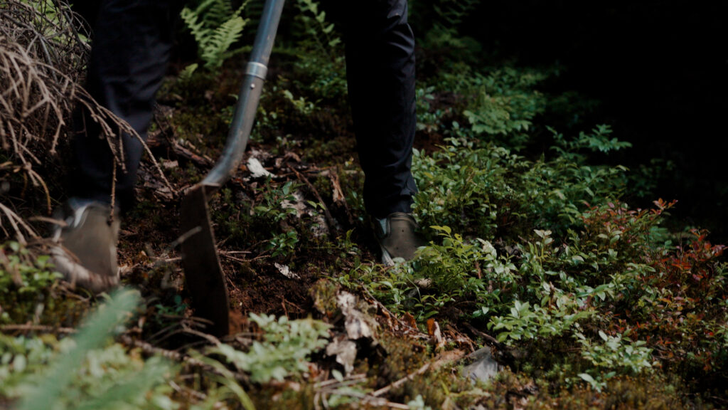
But drones can’t capture everything. That’s why we also have to verify their findings by taking some on-the-ground measurement ourselves. It’s a very hands-on process and can get a little messy when we start digging in.
So, with our drone mapping completed, trowels in hand and corers queued up, we moved from sky to land to verify tree data and do some soil sampling. Methods for this include measuring tree trunk diameters and heights, digging soil pits, and taking soil cores in 400-metre-square plots — and then plugging in the numbers to scale up the calculation from tree and soils to plot to forest.

Participants learned how to verify those air-based estimates with on-the-ground measurements, from tree trunk diameters and heights to soil core samples, the latter of which involves pushing a cylindrical tool into the soil to collect a tube-shaped cross-section of earth that often shows distinct sections, each with different amounts of stored carbon. The sections — marked by changes in colour, and texture — that have different amounts of carbon stored. To know for sure, we separate each of these sections into its own resealable bag, pop them into a cooler, and then send them to a lab to be analyzed for their carbon content. Participants in the training picked up on the skill quickly, taking excellent and efficient samples, and learning how and where to section off distinct layers for analysis.

Scaling up…
It’s remarkable how much we can learn from measuring the carbon content of trees and soils in a forested study area. In fact, the two datasets combined get us about 98% of the way to a full ecosystem carbon stock in forests like the one we sampled during the training.
For the purposes of the training, our work was contained to a single plot, and we did everything short of packaging up soil to send to a lab for analysis. But in practice, a complete carbon measurement protocol for a single plot would only take a few hours and a few calculations before giving us the big picture. A single mature silver maple, for example, can store hundreds of kilograms of carbon in its trunk, foliage, bark and branches, and more in its root system. Scaling up from tree, to plot, to forest, to a province-wide view — and accounting for soil carbon content — you’re looking at more than one billion tonnes of carbon stored by forested areas in New Brunswick alone.
…and staying local
Once trainees learn how to collect this information, it’s theirs. Data sovereignty — the idea that knowledge generated about a place should be owned and controlled by those who claim and steward that place — is at the core of our carbon measurement program. It’s also why we’ve made all our Nature Meets Carbon Project training resources public, so community members can keep honing their skills while teaching others.
So, what’s next for the carbon measurement team? We ‘re expanding training sessions across the country, with recent sessions in Fort Severn and Chippewas of the Thames First Nation just having wrapped up, and with much more planned for the approaching field season.

For more information on carbon measurement, visit the WWF-Canada carbon measurement page, or check out our carbon map.
WWF-Canada’s carbon measurement community of practice training and other materials are supported in part by Bell and RBC Foundation.
