Support WWF-Canada Today
Help protect threatened species and their habitats.
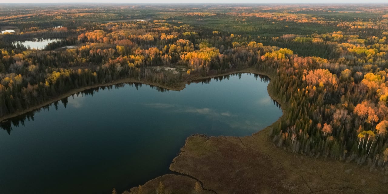

Photo © Casa Di Media Productions / WWF-Canada
Download the report:
Mapping Canada's Carbon Landscape was completed in partnership with McMaster University’s Remote Sensing Lab and is generously supported by Maple Leaf Foods Inc. and the Metcalf Foundation:
Mapping Canada's Carbon Landscape was completed in partnership with McMaster University’s Remote Sensing Lab and is generously supported by Maple Leaf Foods Inc. and the Metcalf Foundation:

High-carbon landscapes play an important role in regulating the Earth’s climate by removing carbon from the atmosphere and storing it in natural ecosystems. If these ecosystems are disturbed, that stored carbon can be released back to the atmosphere, accelerating climate change.
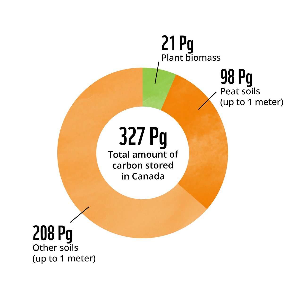
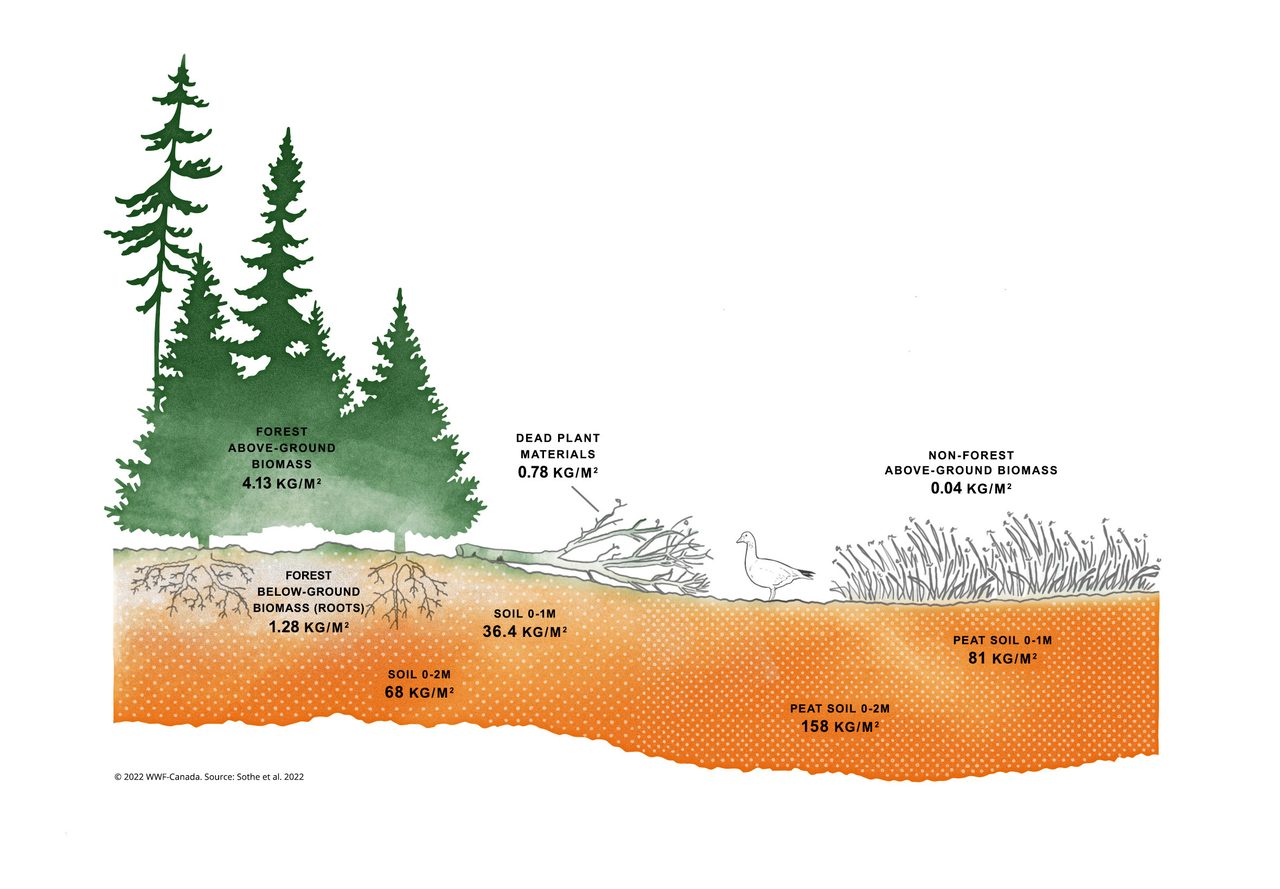
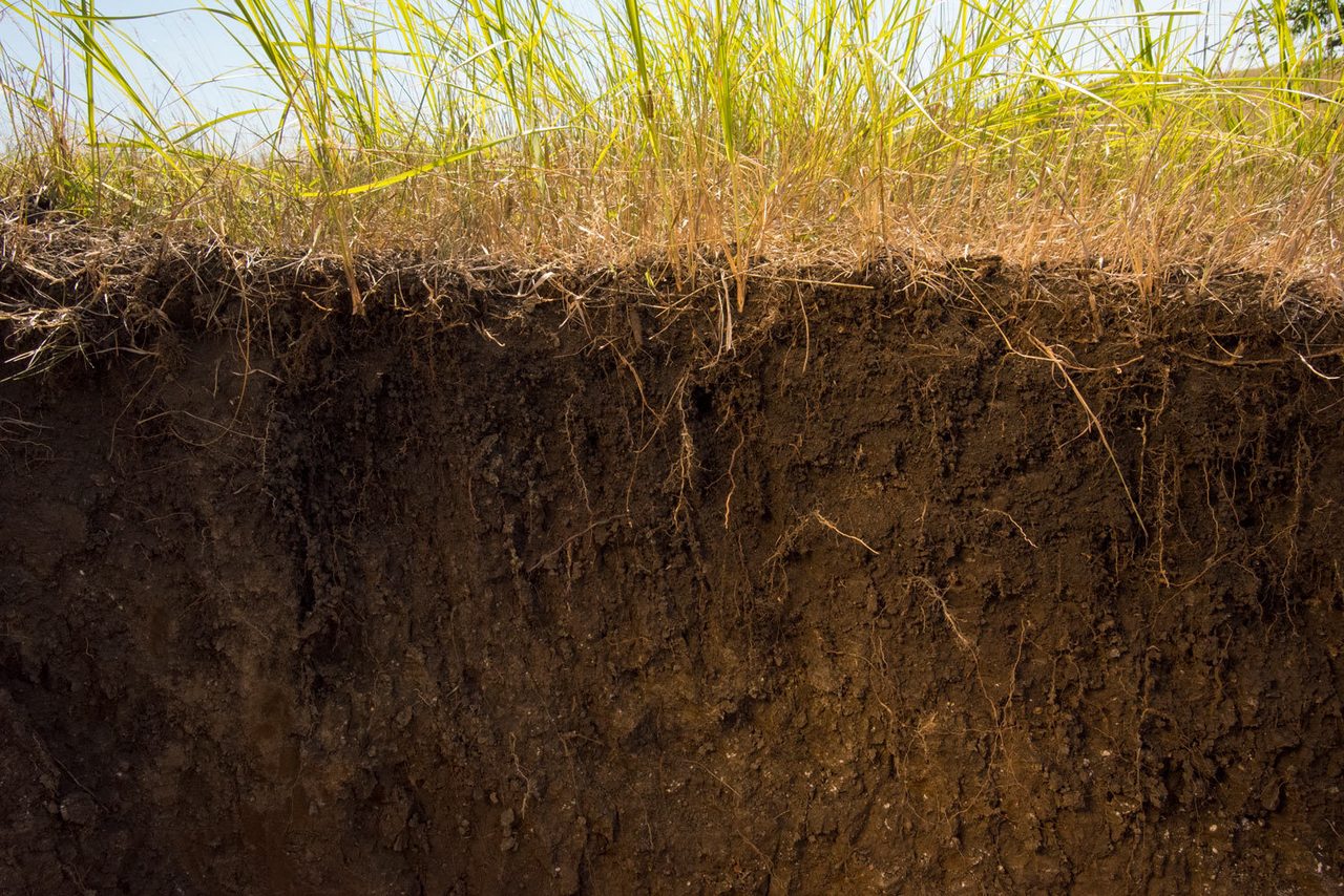
About six per cent of Canada's carbon is stored in vegetation (trees, shrubs, grasses, dead leaves and roots). The remaining 94 percent is found in the top one metre of soil (with 32 per cent of this soil carbon found in peatlands).
Source: Sothe et al. 2022
High-carbon landscapes play an important role in regulating the Earth’s climate by removing carbon from the atmosphere and storing it in natural ecosystems. If these ecosystems are disturbed, that stored carbon can be released back to the atmosphere, accelerating climate change.
A new study by WWF-Canada, led by scientists at McMaster University’s Remote Sensing Lab, has measured, for the first time, how much carbon is stored in Canada’s landscapes, and where the biggest stores can be found. The results are staggering: Canada stores a massive 327 Pg (that’s 327 billion tonnes) of carbon in its terrestrial ecosystems — equivalent to about 25 years of human-caused global greenhouse gas emissions at 2019 emission levels. Large carbon storage areas are often found in Indigenous territories, as a result of millennia of responsible management by Indigenous Peoples.
OVERVIEW
To see an interactive carbon map and find out how much carbon is stored in a particular part of Canada, check out this link.
View interactive map
Click image to zoom
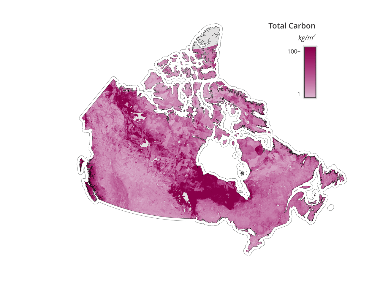
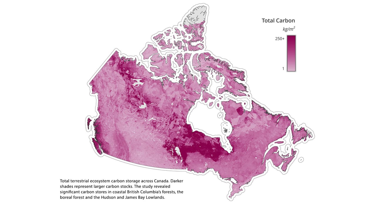
Total terrestrial ecosystem carbon storage across Canada. Darker shades represent larger carbon stocks. The study revealed significant carbon stores in coastal British Columbia’s forests, the boreal forest and the Hudson and James Bay Lowlands.
Source: Sothe et al. 2022
This is the first comprehensive study that has measured carbon above and below ground, and at different depths. It shows the location of carbon in Canada — across all terrestrial ecosystems and at depths of up to two metres — and highlights how the right approach to conservation can help keep billions of tonnes of carbon in the ground.
These findings have significant implications for both Canada and the world. Locating high-carbon regions allows for more targeted conservation measures. Implementing nature-based climate solutions (NbCS) — such as protected and conserved areas and active management of landscapes — in these regions can help ensure this globally significant amount of carbon remains locked in nature, and increases the possibility of more absorption in the future. NbCS also provide important habitat for wildlife, including for at-risk species, allowing us to fight climate change and biodiversity loss at the same time. These strategies must be implemented in collaboration with Indigenous communities, where and when requested, in a way that respects Indigenous rights, knowledge and governance.
OVERVIEW
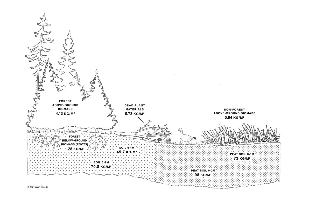
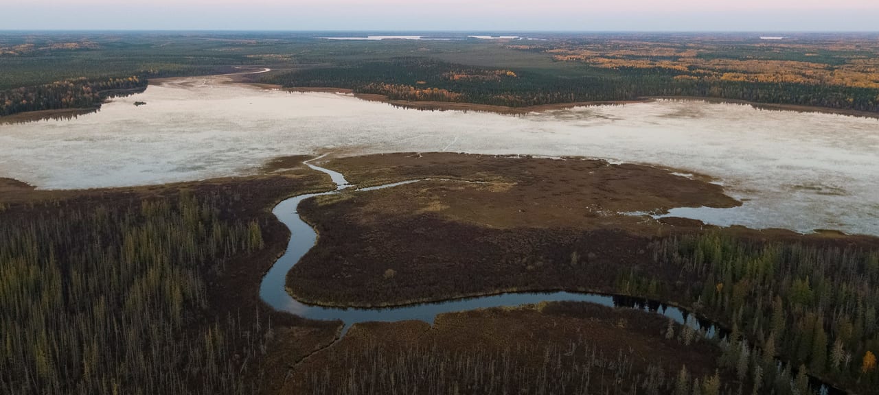
Terrestrial ecosystems store carbon in plants and soils (marine and coastal ecosystems also store large amounts of carbon, known as “blue carbon”). To date, most studies have focused on understanding how much carbon is stored above ground (in trees and other plants, for example). This research, however, revealed that when you look below ground and get into deeper levels of soil, there are massive deposits of carbon. This is especially true for peatlands, a type of wetland found throughout the country, with large swaths found in northern Ontario and Quebec. Canada has an estimated 1.1 million square kilometres of peatlands — about 12 per cent of the country and second in size only to Russia.
Key Findings
Source: consectetur adipiscing elit. Nam sed risus porta, vestibulum neque et, vestibulum urna.
Carbon is stored in different amounts at different depths. The average amount of carbon is highest in soils — particularly in peatlands.
Canada’s terrestrial ecosystems are known to store a large amount of carbon in plants, soil and peat, but until now, there hasn’t been a comprehensive study that looked at carbon above and below ground at different depths. A new study by WWF-Canada scientists and researchers at McMaster’s Remote Sensing Lab shows the location of carbon in Canada — across all terrestrial ecosystems and at depths of up to two metres — and highlights how the right approach to conservation can help us keep billions of tonnes of carbon in the ground. The findings will change the way we approach conservation in Canada by helping us fight climate change and biodiversity loss at the same time through nature-based climate solutions — strategies that use the unique powers of nature to catch and store carbon while also benefitting wildlife.
Click image to zoom
OVERVIEW

Key Findings
Click image to zoom
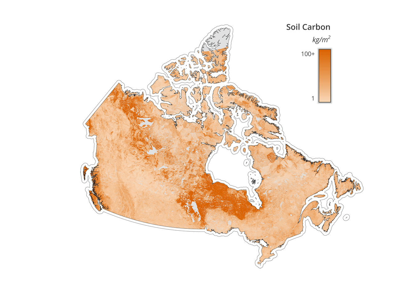
Carbon can also be found in soil (including peatlands) throughout the country. Darker shades represent larger carbon stocks.
Source: Sothe et al. 2022
This map shows that soils store considerably more carbon than plant biomass, although there is a lot of variability depending on the location and the depth of soil. Peat soils are the most carbon rich.
Click image to zoom
Source: Sothe et al. 2022
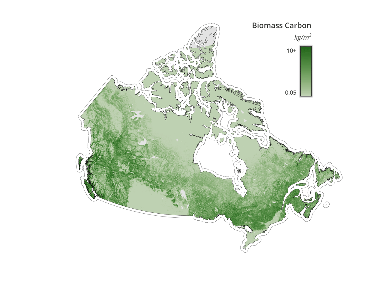
Carbon can be found in plant biomass (vegetation) throughout the country, including forests, shrubs, dead plant material, grasses, and roots. Darker shades represent larger carbon stocks.
This map shows levels of carbon in forests and other types of vegetation (stems, branches, barks, seeds, flowers, and foliage of live plants) that are found above ground, as well as plant roots and dead plant materials.
Carbon stores can be found throughout each province and territory. However, the amount of carbon present depends on the ecological makeup of the landscape.
This map represents the average provincial and territorial breakdown of carbon in the country. Hover over each province or territory to find out the average amount of carbon contained in biomass and soil.
Key findings
Our work has also revealed several ecozones in Canada that are extremely high in carbon, including the boreal shield, Hudson plain and Pacific maritime. A few key regions, which are found in these ecozones and where discussions of NbCS are especially critical, are highlighted here.
Key Regions
© Christian Friis / Canadian Wildlife Service
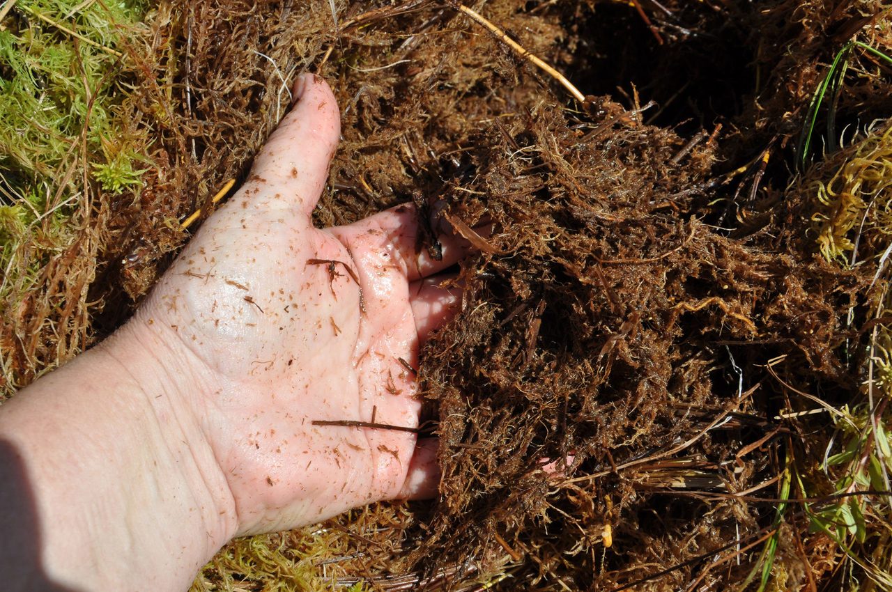
Peat in Hudson and James Bay Lowlands © Serena Maki
Peatlands derive their name from the accumulation and burial of “peat” soil — organic plant material that’s only partially decayed. This slow and partial decomposition is due to the waterlogged conditions of the ecosystem. Globally, peatlands store nearly twice as much carbon as all the world’s forests combined. In northern Canada, one square metre of peatland contains about five times as much carbon as the same area of Amazon rainforest.
Disturbed peatlands throughout the world emit two gigatonnes of carbon dioxide each year, which is equivalent to five per cent of human-produced greenhouse gases (or the annual output of 500 coal plants). Canada is home to a quarter of the world’s remaining peatland carbon stores.
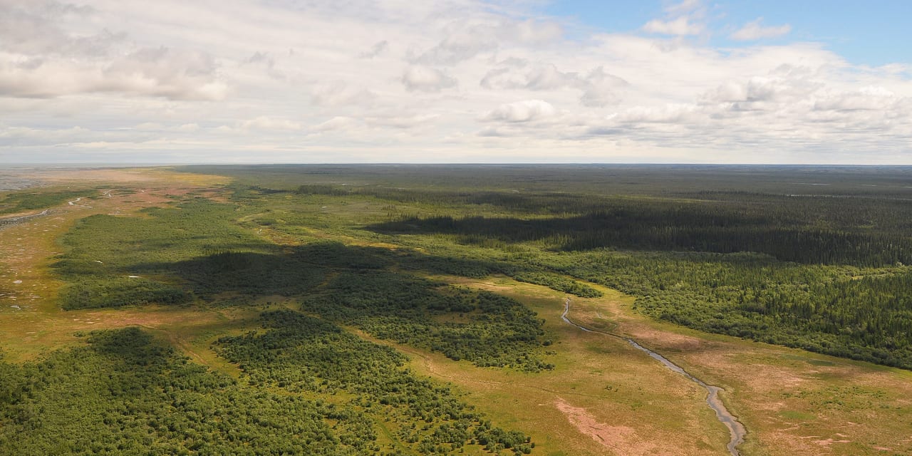
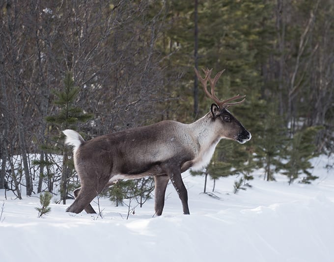
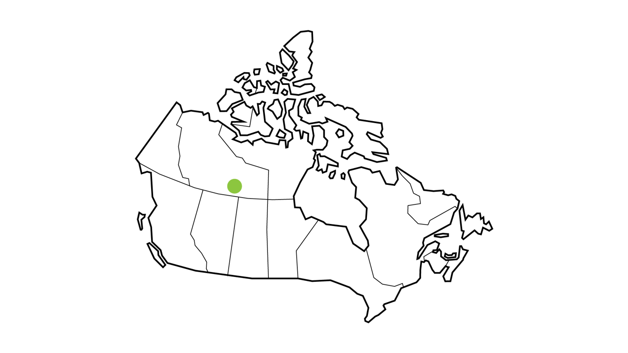
The Hudson Bay and James Bay Lowlands, stretching across northern Ontario into Manitoba and Quebec, are one of the largest peatland complexes in the world. The Hudson Plain ecozone, of which these lands are a part, has an area of 349,000 km² and stores 38 Pg of carbon in the first metre of soil and 74 Pg C at 0-2 metres of depth. This is considerably more soil carbon per area than any other ecozone in Canada.
The area is home to numerous Indigenous communities, including seven First Nations who form the Mushkegowuk Council, which is participating in field sampling in the region. It hosts a large diversity of wildlife, including wolverine, caribou, lynx and even polar bears in its most northern region. It’s also an important habitat for migratory birds, such as the palm warbler.
Despite its importance, the area is under threat from development (a hotbed of mineral deposits known as the “Ring of Fire” is found in the area). Mushkegowuk Council Chiefs have called for a moratorium on the Ring of Fire until a proper protection plan is created for the area.
Key Regions
© Ola Jennersten
© Casa Di Media Productions / WWF-Canada
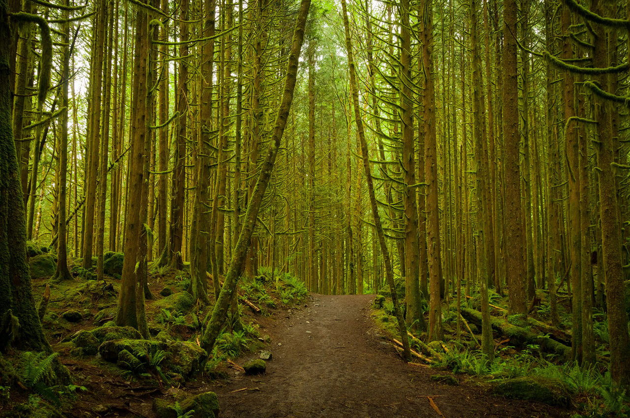
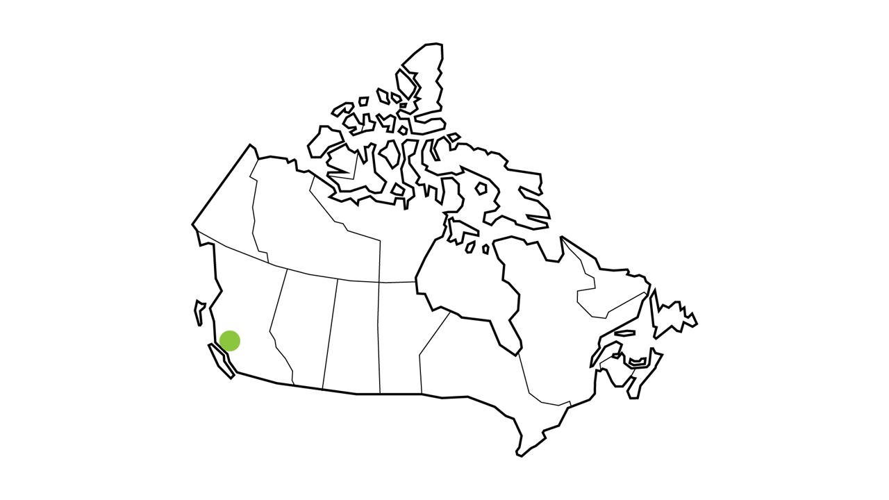
The mountainous and forested ecosystems of coastal British Columbia have a mild and moist climate and are home to some of the tallest trees in the world. These old growth forests are incredibly important to carbon storage and biodiversity.
The trees in this region store the highest amount of plant carbon (more than 5.5 kg of carbon in every square metre, on average) compared to other landscapes. This high-carbon ecosystem is home to the marbled murrelet, coastal tailed frog and salmon.
It’s also at risk from logging and destruction and degradation from increased land use and land-use change.
Key Regions
Golden Ears Provincial Park BC © SibsUK / Shutterstock
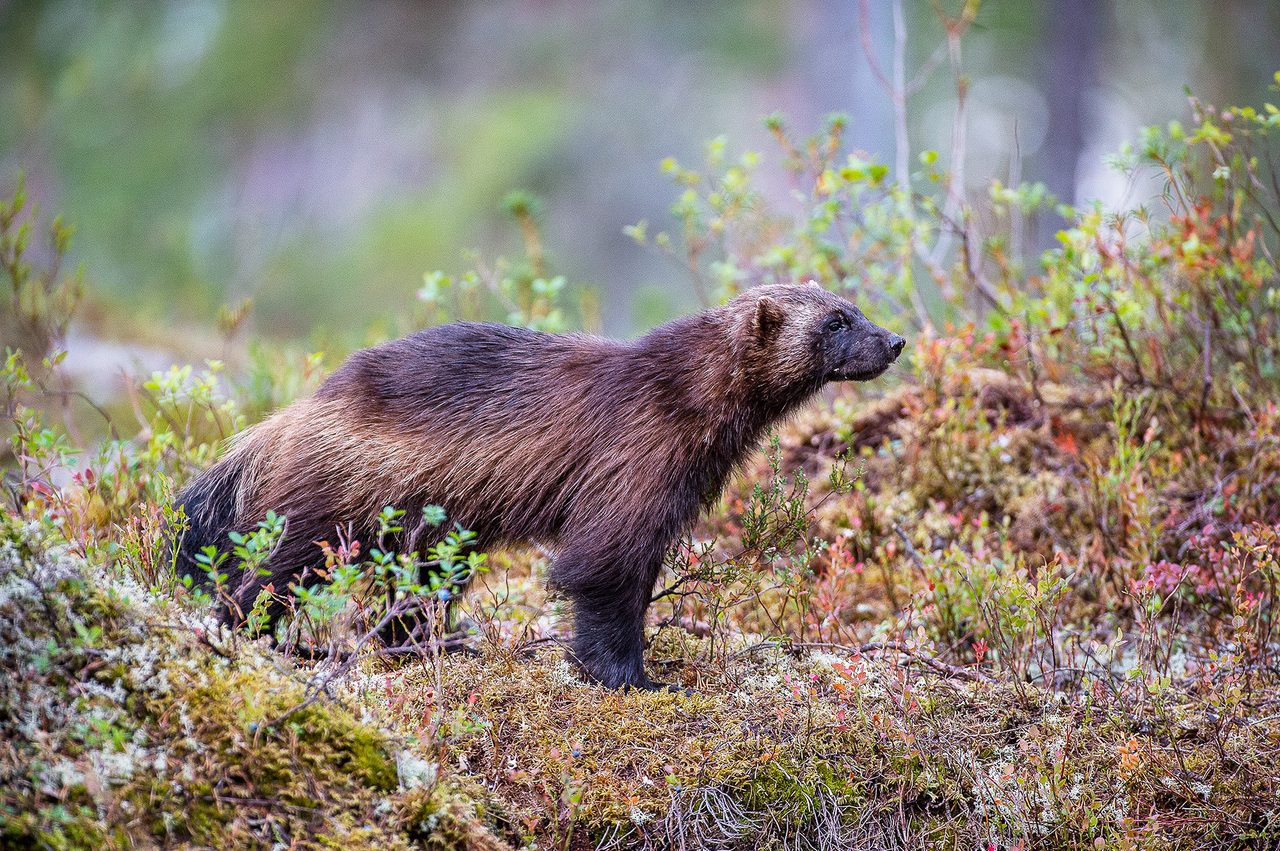
Canada’s boreal forest stretches from Yukon and northern B.C. all the way to Newfoundland and Labrador. Like the Hudson and James Bay Lowlands, the reason the boreal stores so much carbon is because there’s so much peat. Even plants in the region store lots of carbon — on average, about five kilograms of carbon are stored in every square metre.
The boreal forest is under threat from natural resource extraction, such as mining and the creation of roads to reach these operations. It is home to many wildlife species, including caribou, the olive-sided flycatcher and tree swallows.
Key Regions
© Shutterstock
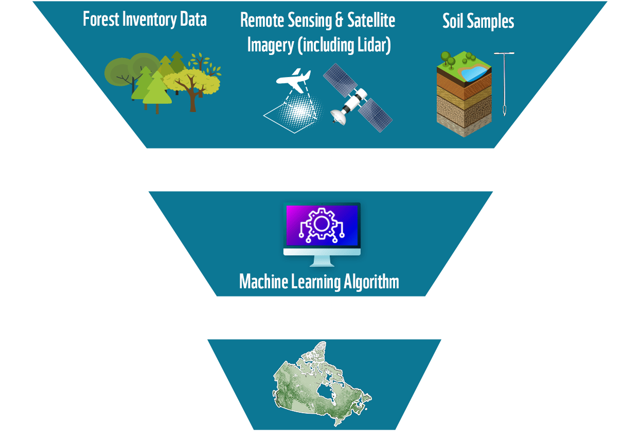
Over the span of two years, the research team fed data from existing soil samples collected from across the country, as well as long-term satellite data, satellite-based lidar and topographic and climate variables, into a machine-learning algorithm. (This means that the more data that is available, the better the algorithm can predict carbon concentrations.) Researchers were able to estimate carbon at a 250-metre spatial resolution in different carbon pools (soils and plant biomass), as well as at multiple depths (1–2 metres).
METHODS
The immense amount of carbon stored in Canada provides many opportunities. Protecting and properly managing the landscapes are examples of nature-based climate solutions that can help combat the climate crisis by preventing the release of stored carbon into the atmosphere. They also create resilience against climate-related events such as flooding and extreme temperature changes while providing habitat for species at risk.
Leaving these areas unprotected poses significant risks. Disturbing the land (through development, mining or agriculture, for example) will release carbon that’s been stored for millennia into the atmosphere, exacerbating already-dangerous levels of carbon emissions and threatening Canada’s ability to meet its commitments to international climate targets.
Disruption and degradation of these ecosystems comes with social and cultural risks as well. The lands have benefited from generations of Indigenous stewardship, which have helped to safeguard key ecosystems that contribute to climate regulation and food security, and are of cultural significance. Disturbing them would negatively impact access to community hunting grounds and important cultural areas, among other important uses.
Understanding the spatial distribution of carbon stores across the country can help with their protection. Canada has the opportunity to showcase how powerful nature-based climate solutions can be in the fight against biodiversity loss and climate change.
It also underscores the importance of working with Indigenous communities and advocating for Carbon Guardians programs and the creation of more Indigenous Protected and Conserved Areas, in which Indigenous communities would lead stewardship of the land, ensuring food security, sustainable harvests and economic development.
Discussion
© WWF-Canada / Casa Di Media Productions
Download our
Recommendations for Action
Download our Recommendations for Action
To read more about WWF-Canada’s recommendations for action, click here
Recommendations
a. Including targets for avoided emissions as part of Canada’s Nationally Determined Contributions.
b. Improving monitoring and reporting of emissions from ecosystem carbon storage areas, especially for peatlands, as part of Canada’s international emissions reporting.
Ensure that Canada has a clear framework for international carbon reporting and accounting for nature-based climate solutions by:
Develop a set of financial mechanisms — defined and supported collaboratively by Indigenous nations and communities, financial institutions, governments and responsible businesses — to support stewardship of carbon storage in nature.
2
Establish and fund a Carbon Guardians program to support interested Indigenous communities and governments in the monitoring and measurement of ecosystem carbon.
1
Avoid the conversion and degradation of large stores of carbon in nature by:
a. Creating protected and conserved areas designed to maximize carbon storage.
b. Legislating that environmental impact assessments by all levels of government take into account the presence of ecosystem carbon stocks and quantify and consider carbon emissions associated with the conversion and degradation of carbon stored in nature.
c. Managing areas of high-carbon stocks to allow continued storage of carbon and an enhanced ability to absorb it in the future.
All levels of government need to take urgent and meaningful action to combat the biodiversity and climate crises. WWF-Canada is actively working to support the following initiatives and seeks opportunity for collaboration with government and other actors to help make Canada a global leader in protecting and managing ecosystem carbon.
Since September 2021, the Mushkegowuk Council has been leading trainings for community-led field sampling of the Hudson Bay and James Bay Lowlands in partnership with researchers from WWF-Canada and the Remote Sensing Lab at McMaster University. This work will help provide more ground data to better understand carbon levels throughout the region.
By combining scientific research and Indigenous knowledge, the findings from the sampling effort will also advance Indigenous-led conservation in an area that’s globally significant for carbon storage, biodiversity and culture. The data will be crucial to help Canada prioritize nature-based climate solutions that can reduce carbon emissions through both avoided emissions and active sequestration.
Next Steps
© WWF-US / Clay Bolt
Since September 2021, the Mushkegowuk Council has been leading trainings for community-led field sampling of the Hudson Bay and James Bay Lowlands in partnership with researchers from WWF-Canada and the Remote Sensing Lab at McMaster University. This work will help provide more ground data to better understand carbon levels throughout the region.
By combining scientific research and Indigenous knowledge, the findings from the sampling effort will also advance Indigenous-led conservation in an area that’s globally significant for carbon storage, biodiversity and culture. The data will be crucial to help Canada prioritize nature-based climate solutions that can reduce carbon emissions through both avoided emissions and active sequestration.
Next Steps
© WWF-Canada / Casa Di Media Productions
RESOURCES
This analysis was completed by Sothe et al. (2022). The accompanying journal article is published in Global Biogeochemical Cycles (DOI: 10.1002/essoar.10507117.2) and data can be accessed online.
WWF-Canada's Carbon Mapping Recommendations
WWF-Canada's Carbon Mapping Executive Summary
Help protect threatened species and their habitats.
