What are riparian buffers? And how does restoring them on private lands create (literal) downstream benefits?
Imagine a raindrop falling onto a forested slope in B.C., where, pulled by gravity, it enters a network of interconnected ecosystems: trickling through soils, filtering through wetlands, flowing into streams and rivers and eventually reaching estuaries and coastal waters into the open ocean.
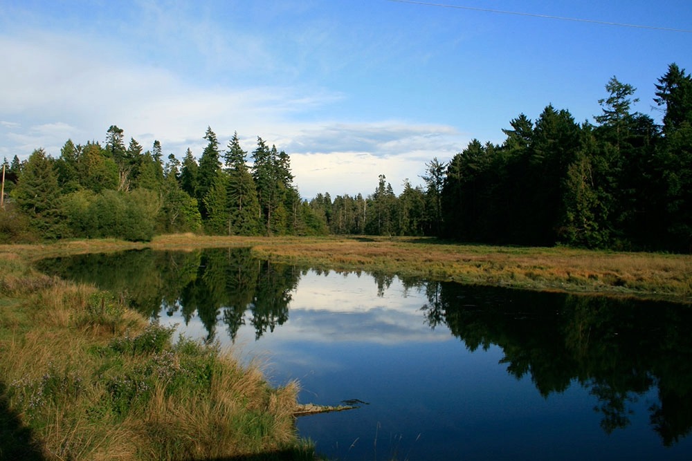
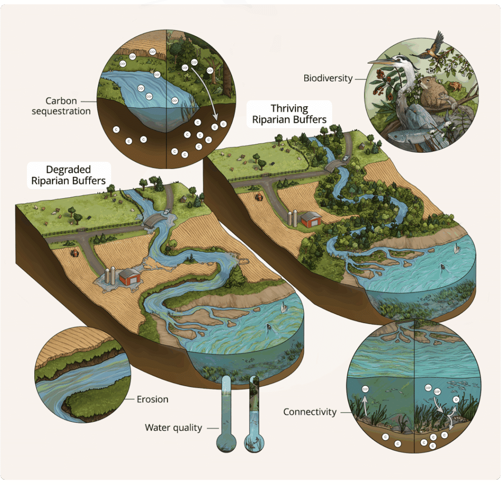
Known as a watershed, this dynamic transition zone between land and sea plays a vital role in regulating water ecosystem health. Alongside all the rivers, lakes and streams criss-crossing these watersheds are natural riparian buffers that act as transition zones between the waterways and dry land.
Covered by plants, trees and shrubs that are adapted to moist conditions, these buffers act as nature’s filtration system, removing pollutants, stabilizing banks, reducing erosion, providing shade and preventing floods. They’re essential for clean water to make its way into coastal habitats like eelgrass meadows and tidal marshes that support shellfish, salmon and other species.
The problem: Damaged buffers
But centuries of land use — deforestation, agriculture and urban development — have fragmented and degraded riparian buffers. Without them, pollution from fertilizers, sewage, and runoff from farms and cities flows downstream, harming marine life and weakening ecosystems that coastal communities rely on.
These pollutants include excess nutrients that can overwhelm the environment, creating “coastal eutrophication,” which causes algae to grow out of control. The resultant “algal blooms” block sunlight from reaching other coastal vegetation, leading to less oxygen in the water and less carbon stored in the sediment and root systems.
The solution: Restored buffers
Now imagine that raindrop has travelled all the way down to the Little Campbell Watershed and into the Ta’talu, also known as the Little Campbell River, just north of the Canada-US border.
As the Ta’talu flows out from its headwaters in the heavily agricultural Township of Langley, it curves through the small coastal communities of South Surrey and White Rock and into the Semiahmoo First Nation Reserve where it enters Semiahmoo Bay. During this 30-kilometre trip to the ocean, the river runs though farmland and pastures, across golf courses and country clubs, under highway overpasses and between housing developments.
But like too many other rivers in Canada, the riparian buffers along the Ta’talu and its tributaries have become degraded. In some areas, invasive reed canary grass, which thrives in disturbed areas, has taken over, outcompeting native plants and preventing them from rooting. The canary grass’s root systems are so dense that they can alter the flow of water, causing erosion in some areas and stagnant or slow-moving sections in others, which compromises water quality.
This is particularly problematic because once this river water mingles with the ocean, it needs to maintain a delicate balance of nutrients to support eelgrass meadows and the species that live there, like Dungeness crab and at-risk juvenile Pacific salmon.
The challenge: Fragmented ownership
Data collected from the Ta’talu has shown water quality is better in areas with intact riparian buffers, but restoring degraded ones is often complicated by the issue of land ownership along a river.
Across B.C., and all over Canada, rivers flow through a mosaic of federal, provincial, municipal, Indigenous and private lands, each governed by different regulations, priorities and stewardship practices. This fragmentation makes it challenging to coordinate restoration efforts across entire watersheds, especially when degraded areas span more than one jurisdiction.
That’s why the stewardship of private landowners is so key to sustained watershed health. By acting on their own lands, landowners can fill in gaps in restoration where public agencies might not have access and protect their investment.
Restoring riparian buffers directly benefits landowners by creating more climate-resilient ones that prevent erosion and flooding, which can lead to loss of crops and damaged infrastructure, and retain more water during droughts.
Benefits also flow downstream by improving water quality beyond their property line and complementing other conservation work in the watershed. In other words, it’s a win-win for landowners, wider communities and wildlife.
Private land stewardship in action
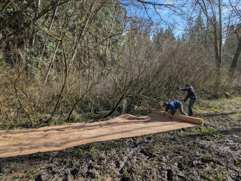
In 2024, a local agricultural landowner whose property includes 300 metres of a Ta’talu tributary riverbank took action by partnering with WWF-Canada and A Rocha Canada to restore degraded riparian habitat.
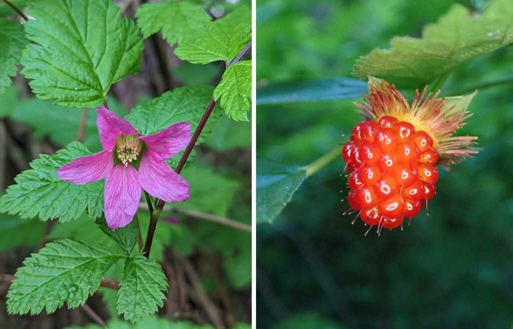
Ongoing over the last year, it involved removing reed canary grass and laying down coconut fibre matting in the buffer zones. This technique blocks sunlight to the invasive grass while being malleable enough to plant native trees and shrubs into the bank, which stabilize it. Partners have planted 45 trees and 343 native shrubs so far, including red twig dogwood, salmonberry, western red cedar and two types of maple trees, with more work planned for the spring.
The 400 square metres restored, and now reconnected to 30,000 square metres of intact buffer, is helping improve water quality, enhance wildlife habitat and strengthen the land’s ability to sequester carbon and filter nutrients.
That drop of water travelling through the Ta’talu now enjoys more effective filtration thanks to this buffers’ healthy native vegetation — providing more oxygen to young salmon before they head out to sea and bringing cleaner water into Semiahmoo Bay.
This Ta’talu story is itself just one drop in the river of needed watershed restoration, but it shows how a property-owning protagonist can take the lead to support wildlife and people.
This project was undertaken with the financial support of the Government of Canada. The infographic was also financially supported by the Hewitt Foundation and Wawanesa Insurance through their Climate Champions program.
