Smile, salmon – you’re on candid camera. Across Canada, freshwater protection is in high gear
Did you know solar-powered underwater cameras are being used to count Atlantic salmon? That border-control crossings are stopping invasive fish from entering the Great Lakes? I bet you didn’t know beavers in Alberta are getting an image makeover.
I’m constantly amazed and inspired by the incredible work being done across the country, with help from WWF’s Loblaw Water Fund, to make freshwater ecosystems healthier for wildlife and communities – for people like the First Nations near Great Slave Lake who are testing the water for pollutants from mines, or people in B.C. who are learning to rebuild lost wetland habitat to improve freshwater conditions in the Arrow Lakes area. With the WWF Loblaw Water Fund field season done, we’re thrilled to share some of this year’s successes.
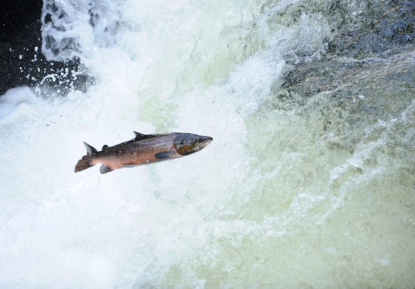
Close-ups of salmon in Newfoundland
A solar-powered underwater camera has been recording Atlantic salmon – assessed by the Committee on the Status of Endangered Wildlife in Canada as Endangered – as they migrate through the Indian Bay freshwater ecosystem in Newfoundland and Labrador. The Indian Bay Ecosystem Corporation will use the videos to estimate how many are returning to spawn in the river in which they were born, then compare that with information from past years to assess the size of the salmon population. More than 11,000 videos have been recorded so far. Water monitoring and habitat restoration work will also help these vulnerable fish.
Streaming data in Quebec
The best conservation work is built on a foundation of solid knowledge. In the Abitibi and Harricanaw sub-watersheds in Quebec, preliminary water quality analyses in streams and other surface water by the Organisme de Bassin Versant Abitibi-Jamésie will help paint a clearer picture of the state of the freshwater ecosystem, on which future actions can be based.
Border control in Ontario
The largest remaining coastal wetland on the western side of Lake Ontario is home to rare plants and threatened animals, including the least bittern, Blanding’s and Northern map turtles, and Jefferson salamanders. But Hamilton’s Cootes Paradise and Grindstone Creek marshes, which make up this wetland, are at risk from invasive species, pollution and habitat loss. Our Living Planet Report Canada showed an average 32 per cent decline in freshwater fish populations in Lake Ontario since 1970. To prevent invasive carp from entering the marshes, Royal Botanical Gardens (which owns and manages the land) monitors all fish entering and leaving the Fishway.
A makeover for Alberta’s beavers
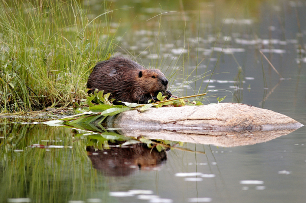
Beavers get a bad rap, especially with landowners. In Alberta, workshops put on by Cows and Fish (the Alberta Riparian Habitat Management Society) are helping landowners and municipalities in the North Saskatchewan River Watershed better understand the benefits beavers can provide for their land and the ecosystem overall, and the management options – like pipes overtop dams to prevent flooding, and barriers to prevent damming of culverts – that will help minimize the bad while maximizing the good.
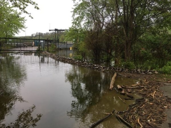
Monitoring an urban lake in Manitoba
Urban watersheds face many challenges, including, surprisingly, a lack of data about the overall health of the freshwater ecosystem on which so many people depend. With algae blooms that can be seen from space, Manitoba’s Lake Winnipeg is particularly worrisome. The data we do have tells us the Winnipeg watershed is already enduring “very high” stress. Loblaw Water Fund grantee Fort Whyte Foundation Inc. is working with partners to standardize freshwater monitoring so data collected by conservation organizations, government and citizen scientists can be shared and used to improve the health of the lake.
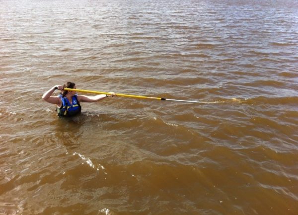
Tailing old mines near Great Slave Lake
The Regional Akaitcho Water Monitoring Program is tracking the quality and quantity of water downstream from both old and active mine sites near Great Slave Lake, to fill in data gaps and address Akaitcho First Nations’ concerns about water quality. To date, 11 sites chosen by the communities have been monitored. In addition to contributing to the overall water quality picture, the community-led monitoring effort is deepening connections to land and water.
Training for wetlands in B.C.
Some people want to be citizen scientists, some are even more hands on – and are learning how to create new wetland habitat where it has been lost. In the Arrow Lakes area of B.C., the Columbia Basin Watershed Network Society is teaching people how to “install” wetlands, and how to identify other sites with the potential for restoration.
Over the last four years, Loblaw Water Fund projects have engaged more than 9,000 volunteers to collect over 1,000 water samples and restore over 200 hectares of habitat for freshwater species. This year’s projects will build on this success. Preserving Canada’s freshwater may be a task as vast as our rivers and lakes are plentiful, but together, with organizations across Canada, it is possible.
If you are a registered charity, conservation authority or non-profit group working to improve freshwater health in Canada, you can find applications and guidelines for funding at wwf.ca/waterfund.
