Measuring forest carbon at the push of a button
Monitoring carbon in nature allows us to understand the effects that protecting, managing and restoring habitats (known as nature-based climate solutions, or NbCS) have on reducing carbon in the atmosphere. Current approaches are costly, unreliable, and time- and labour-intensive, so WWF-Canada’s Nature x Carbon Tech Challenge sought out more cost-effective and user-friendly carbon-measurement technologies.
Laval University’s Digital Forest Lab was one of three $100,000-award recipients, so we spoke to associate professor Martin Béland about his team’s tech and what winning the challenge means for their work.

How does your technology work?
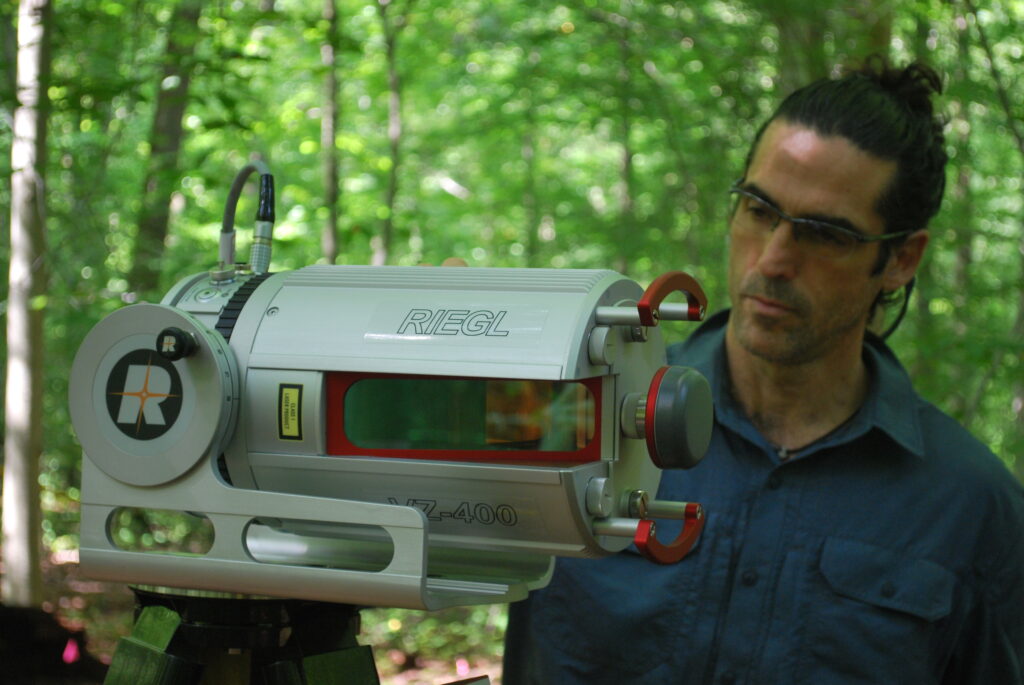
It is developing algorithms and using data analytics to estimate above-ground biomass in forests. Our technology takes data captured from terrestrial LiDAR (light detection and ranging) scanners to generate 3D imagery (point clouds) and corresponding data of a given forest.
At the beginning, it was mostly used for looking at leaf area in forests. But LiDAR can also estimate wood biomass — wood volume. The data is collected with an instrument that is put on a tripod and works like a camera except that instead of taking a picture, it’s taking a 3D point cloud — a 3D description — of the forest around it.
After it’s processed, the data can be used to determine detailed estimates of the biomass found in the trees in any given forest. Knowing the amount of biomass allows us to estimate how much carbon there is in the trunks, how much is in the branches and in the leaves, and then give an idea of its vertical distribution. This kind of data can be used by different kinds of people for different purposes. Beyond the estimation of carbon stocks, it can be used to study the relation between canopy structure and biodiversity and predict forest microclimates in a changing macroclimate.
What makes it accessible and easy to use?
We thought that if we could make it easier on our end to process other people’s data, then we could just send an instrument to people that’s extremely easy to use in the field. The instrument that you use to take the measurements is just like a phone. You just push a button.
The harder part is processing that data. That’s where the Digital Forest Lab comes in. Communities and organizations are able to send data they have collected in the field to our lab, where a research associate can process it and develop a report on the carbon stocks that can be easily interpreted. The process allows those with minimal training to measure carbon in forests.
Where will it be used?

For now, the Digital Forest Lab takes measurements around “sugar shacks” (where sap is boiled into maple syrup) in Quebec, which are sugar-maple production forests. There’s a big interest from the industry to look at carbon sequestration, biodiversity and the effect of biodiversity on the productivity of these forests.
We’re also working in evergreen Boreal forests with existing data from the Canadian Forest Service, specifically from Parc national des Grands-Jardins, and data from the Montmorency Forest, which is managed by Laval University, in Quebec.
In future years, we would like to expand this work in old-growth forests in western Canada, since very large trees hold more biomass and direct biomass measurements using destructive methods are harder to make on those giants.
What kind of benefit will the technology have for climate change?
The technology can be added to the toolbox of NbCS. The idea is to look at the role of forests in sequestering more carbon from the atmosphere. People may have different projects looking at the ways to increase the amount of carbon that is stored in forests, and our tool, in that sense, is a way to measure accurately how much carbon is being stored.
How did the Nature x Carbon Tech Challenge help you achieve success?
It has given us the resources to hire more people — one PhD student and one research associate — who are doing the actual work. The Challenge has also put them in contact with users, which is very useful for us.

