MaPP: A foundation for future marine protected areas
Less than 2% of Canada’s oceans are currently under any form of legislated protection. That number shrinks to 0.2% if you include areas that are off limits to potentially damaging activities. How do we size up with other countries? In a word: poorly. We are outclassed by both the US and the UK, which each have over 9% of their territorial waters under strict “no-take” policies. South Africa and Australia have also shown leadership in ocean conservation, and currently have over 4% of their marine areas protected with no-take reserves.
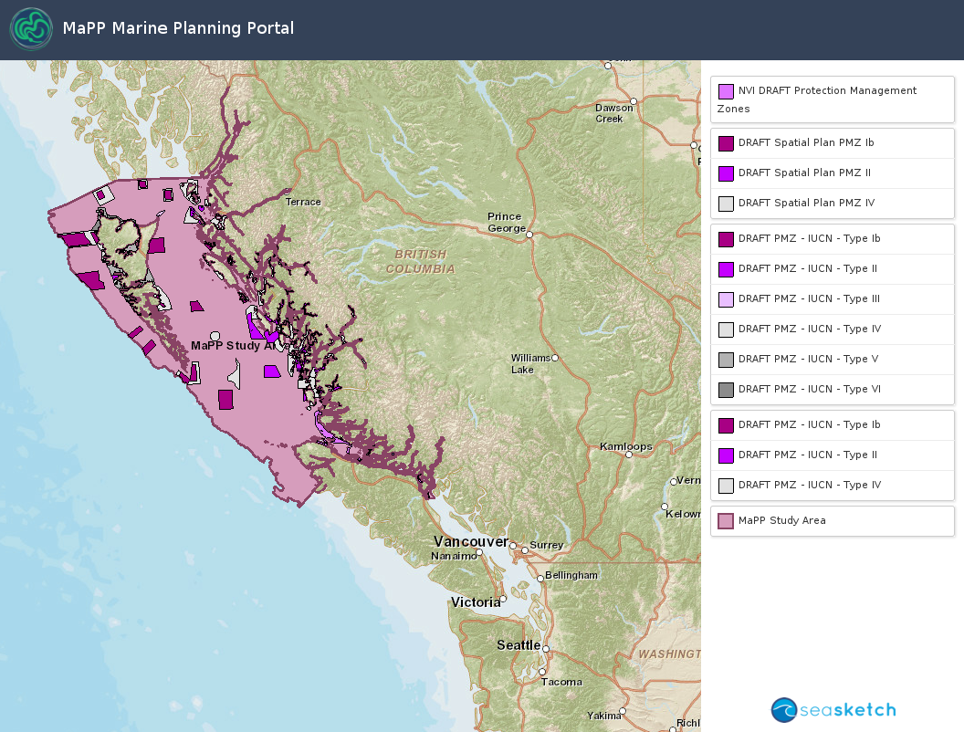
According to Protected Planet Report 2012, Canada ranks 100 out of 172 nations when it comes to protecting its oceans. We’re lagging very far behind in our international commitment to protect at least 10% of coastal and marine environment by 2020 – a commitment made under the Convention for the Conservation of Biological Diversity (CBD). But opportunity beckons with the recent completed Marine Planning Partnership (MaPP) plan for BC’s coast. The plan sets out recommendations to sustainably manage 102,000 km2 of Canada’s Pacific Coast, stretching from Northern Vancouver Island to the Alaska border. If the recommended Protection Management Zones in the plan were to be designated as Marine Protected Areas, the proportion of MPAs in the planning area would increase from less than 2% to over 20%. Such a massive leap for marine protection is unprecedented in Canadian conservation history – needless to say, making this happen would offer a massive boost for Canada’s reputation and obligations. However, there is a catch!
MaPP was co-led by the Province of BC and the 18 First Nations on BC’s coast. Unfortunately, the MaPP plans did not benefit from the participation of the federal authorities principally responsible for developing and MPA network – or rather, the federal authorities haven’t benefitted from being part of MaPP. But they have plenty to gain should they choose to make use of the plans that have been developed.
Since 2012, staff from Provincial and First Nations worked with input from stakeholders in forestry, fishing, conservation, tourism, and other sectors to create a detailed set of priorities, recommendations, and objectives for the MaPP region, including the identification of 18,341 sq. km of Protection Management Zones, which allocate space primarily for conservation purposes. While not legislated Marine Protected Areas, these zones make some of the biggest contributions to the health of the coast. Years of research and analysis have gone into identifying these areas – so much planning, in fact, that the zones were developed with the idea that they would eventually become candidates for inclusion into a network of federally-legislated MPAs.
Now, Federal authorities are embarking with the Province of BC and First Nations on an effort to move forward with the establishment of a network of Marine Protected Areas. Given the years of work to compile information about habitats, species, human uses, and how they all interact, the process would do well to build on the MaPP plans.
