Beaufort Sea Community Tour: Under the midnight sun in Sachs Harbour
WWF goes on the road to share the results of our oil spill modelling with those who would be most affected by a spill: the communities of the Beaufort Sea.
I officially began the community tour to present the results of our oil spill modelling work in late June. In fact, the timing of that first presentation was very significant – it took place on summer solstice, in the community of Sachs Harbour, the northernmost community in Canada’s Western Arctic. June 21, 2014 was also National Aboriginal Day, and just a few weeks after the 30th Anniversary of the signing of the Inuvialuit Final Agreement. It was a powerful reminder that the Inuvialuit (the Inuit of Canada’s Western Arctic) have long been strong stewards of their lands and waters, and will continue to be the decision-makers and leaders that will determine the region’s future. And the future will be interesting….
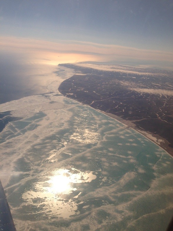
On the southwest corner of Banks Island, the community of Sachs Harbour is already witnessing the effects of climate change. Banks are eroding as permafrost melts, the timing of once-consistent migrations and animal activities is changing, and they are observing new species – most famously the polar bear grizzly hybrid (grolar bear or pizzly) that was harvested near the community in 2008. They are also experiencing economic changes; within a generation or two they have shifted from being largely dependent on the fur trapping and hunting economy to more wage employment. And in a place where a can of root beer costs $4.34, the need for employment in the region could not be more evident.
When I arrived on June 20, sea ice was still present along the coast and in the harbour. The huge migration of geese had already passed, and solitary flocks of eiders floated in the small pockets of open water in the otherwise ice-filled bay. The community was excitedly talking about the beluga that were seen migrating by the floe edge, a few kilometers out from the shoreline. (A hundred kilometers to the west, the Beaufort Gyre drives a continuous current that moves young and old ice clockwise direction in the Arctic Ocean. It is really fascinating and I encourage you to watch this time lapse animation to see exactly how the Beaufort Gyre functions.)
Inside the local school gymnasium, roughly 18 people attended the presentation – quite a turnout in a community of barely one hundred people! Dinner was provided, which included the country foods that local people depend upon: roast goose, caribou stew, Kwak (frozen char), and Ooksuk (seal oil). Many of these foods come from sources that could be affected by an oil spill in the region, as our modelling shows. Following the presentation, we discussed their concerns about the long term impacts on food supply of chemical dispersant being used in the event of a spill. Several hunters commented that the weather conditions are changing, making the winds less predictable, and therefore making the possible spill trajectory less predictable. Incredibly, winds in fact changed during the course of this meeting and pushed all the ice that was in the harbour out to the sea. It was a strong reminder of how quickly things can change here, and how challenging and important it is to plan for this changing future.