Protecting the “Breathing Lands”
Northern Ontario’s evocatively named Ring of Fire — upstream of the traditional territory of the seven First Nations forming the Mushkegowuk Council — is a hotbed of mineral deposits. But that’s not all this area is sitting on.
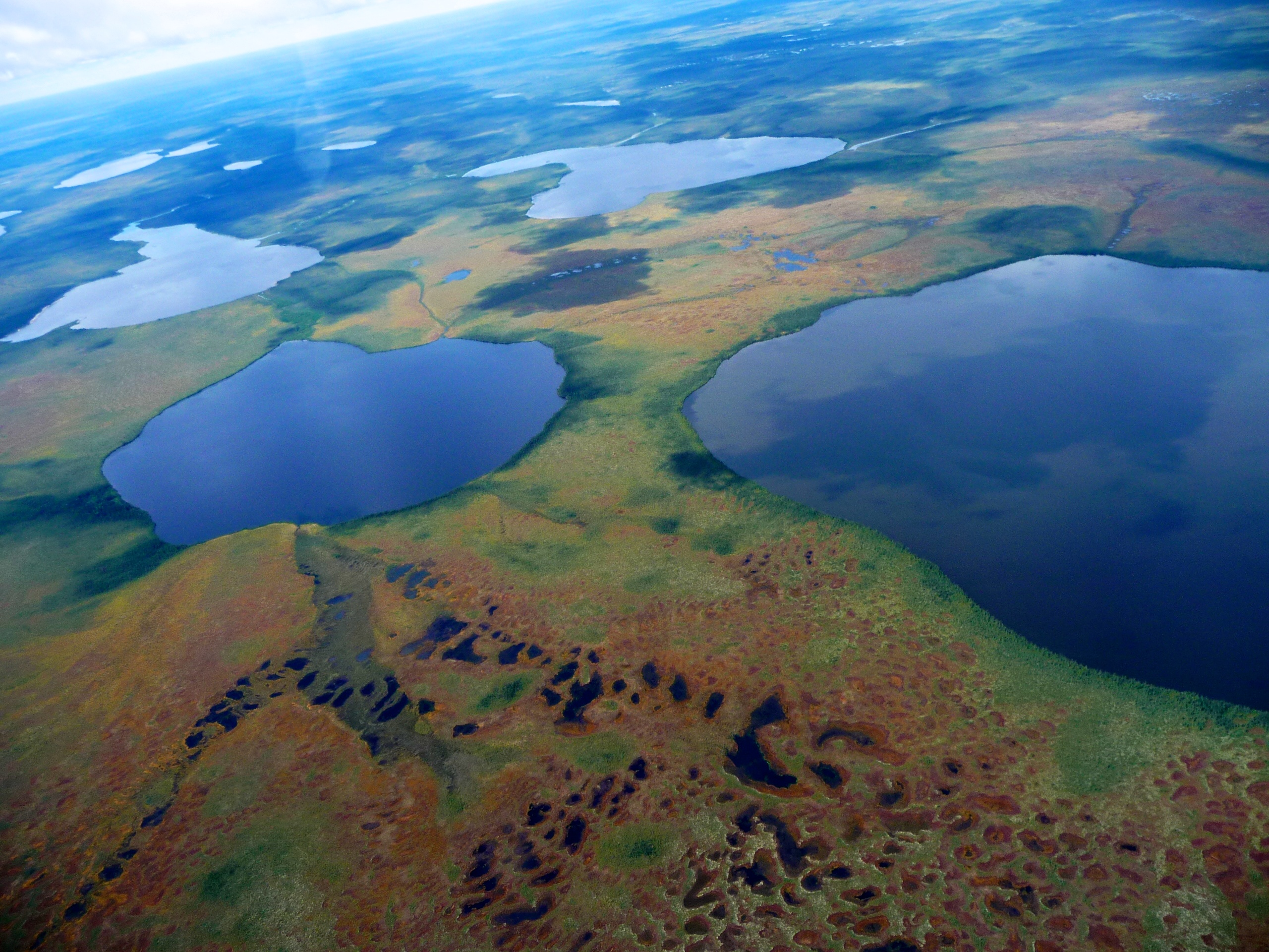
The overlapping Hudson and James Bay Lowlands are pockmarked by peatlands which are an incredibly dense and globally significant carbon storage site containing billions and billions of tonnes.
So, what happens if you disturb that peatland laid down over tens of thousands of years?
WWF-Canada is supporting the Mushkegowuk Council’s call for development moratorium on mining and industrial roads while the necessary baseline information is being gathered. We’re working with the Council to measure how much carbon in stored in their peatlands and determine the actions to ensure long term stewardship. We spoke to James Snider, VP of our Science, Knowledge and Innovation team, to find out more about this peat-inspired partnership.
What makes this region so special?
The traditional territory of the Mushkegowuk Cree extends from subarctic permafrost in the north, where there are polar bears, all the way to boreal forest in the south, where you’ll find species like wolverine, caribou and lynx.
But in the middle is a swath of peatlands, one of the largest networks in the world, and they store thousands of years of accumulated carbon. This vast complex of wetlands and coastal areas are also a globally important habitat for birds, from local Palm Warblers and loons to a whole host of migrating waterfowl and shorebirds.
It’s an area of importance in terms of climate change mitigation, it has tremendous biological and ecological value and, of course, it is home to Indigenous peoples who have been stewarding these lands, also for thousands of years.
Why is peat so important for climate?
Peatlands are a type of wetland — we often say peat bogs — so you have very slow decomposition of the vegetation and it can go down 10 to 15 feet deep. Globally, they hold almost twice as much carbon as forests, and about a quarter of the world’s remaining peatlands are here in Canada.
The important point is that they’ve accumulated all this carbon and it’s sitting in place. It’s crucial that we keep these ecosystems intact and not make the climate crisis even worse by releasing this absolutely massive amount of stored carbon into the atmosphere.
How did the partnership come about?
We’ve been working with the Council for about a year on a joint effort to measure and monitor the carbon stored in the peatlands. The goal is to better understand potential impacts of development on that carbon, and how the Mushkegowuk people can best continue stewarding this territory through land-use planning and tools like Indigenous Protected and Conserved Areas. Together, we’re working to create new resources and materials that can answer these questions and, in turn, be used to inform future decision-making.
What’s next?
To bring together our scientific research approach and Indigenous knowledge systems, we’ve been doing a series of virtual knowledge exchanges with Elders in the Mushkegowuk communities. That’s allowing us to hear directly from the Elders about their relationship with the land and their understanding of these high-carbon areas — in Cree, they’re called the “breathing lands.”
These exchanges will also drive the design of the field sampling that we’ll do this summer. With researchers at the Remote Sensing Lab at McMaster University, we’re putting together training and guidance for a monitoring project that, given COVID restrictions, may be entirely community-run.
