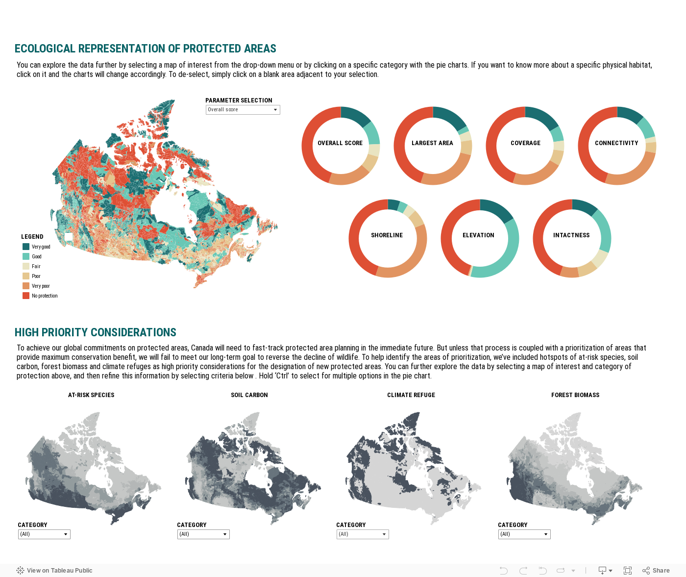
By overlaying gaps in the current ecological representation of our protected areas network, with additional key considerations, WWF-Canada has refined our recommendations for areas to be considered for protection.
WWF-Canada has developed a protected areas siting framework to help identify priorities for the designation of new protected areas. The conceptual and technical development of a gap analysis technique to assess ecological representation of Canada’s protected areas network started during WWF-Canada’s Endangered Spaces campaign nearly three decades ago. At that time, an automated tool was developed to streamline the process of analyzing scenarios for the future designation of protected areas, via rapid assessment. The approach focused on sampling physical habitats – or enduring features of the landscape – and incorporated physical elements as surrogates for the distribution of biodiversity.
WWF-Canada’s Wildlife Protection Assessment builds on that historic framework using updated data, methods, and the incorporation of additional biological and physical considerations such as hotspots of at-risk species, carbon stores in the form of soil and forest biomass, and climate refuges.
Using the interactive tool below you can identify high-impact areas based on varying criteria and thresholds. For this analysis, adequate representation refers to physical habitats with a categorical score of high or very high ecological representation. By contrast, inadequate ecological representation encompasses physical habitats categorized as fair, poor or very poor. Areas that lack a protected area are classified under the label of no protection.
For additional information about methodology and data, please contact [email protected]
Click on the map and headings to learn more.
 © bookguy via iStockPhoto
Help protect threatened species and their habitats.