WWF-Canada presents a pathway to a new model of protected area establishment — one that helps meet biodiversity and climate goals in an ethical and rights-driven way
We know that protecting nature is one of the most powerful tools we have in the fight against the accelerating dual crises of biodiversity loss and climate change. To maximize its potential, however, we need to reimagine our approach to protected and conserved areas in Canada.
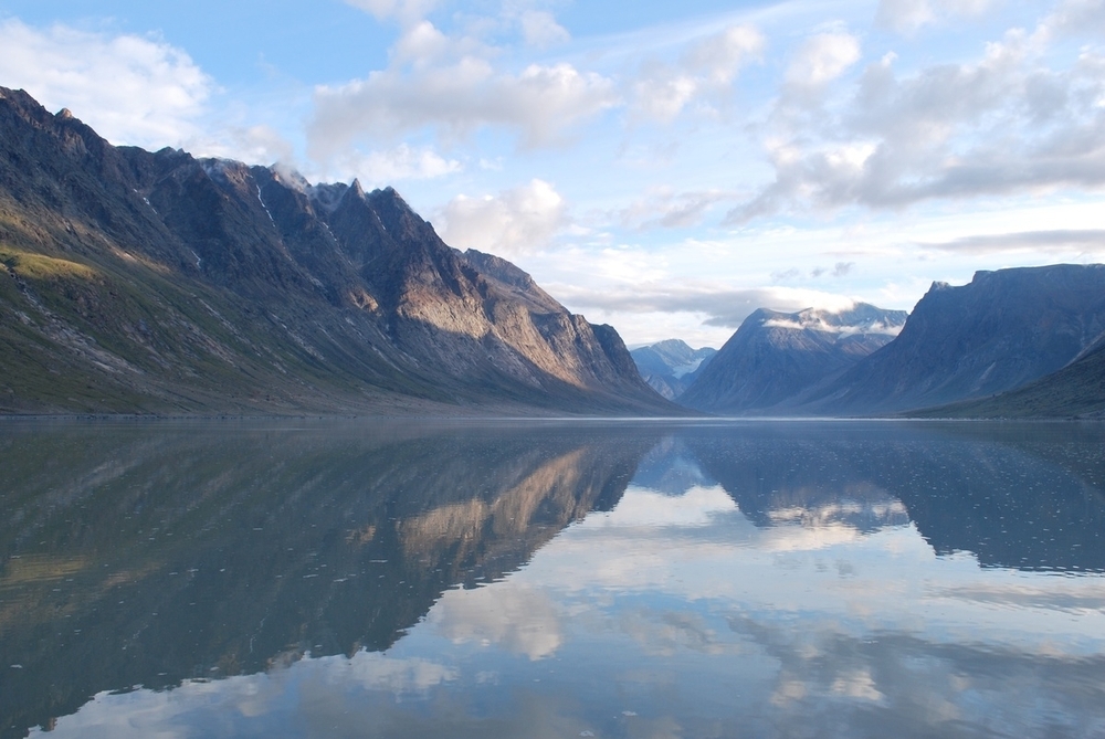
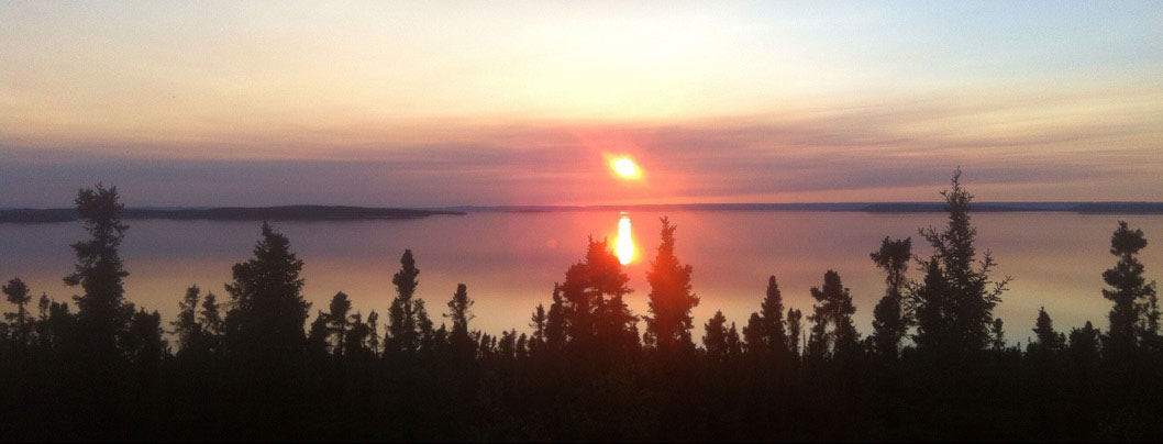
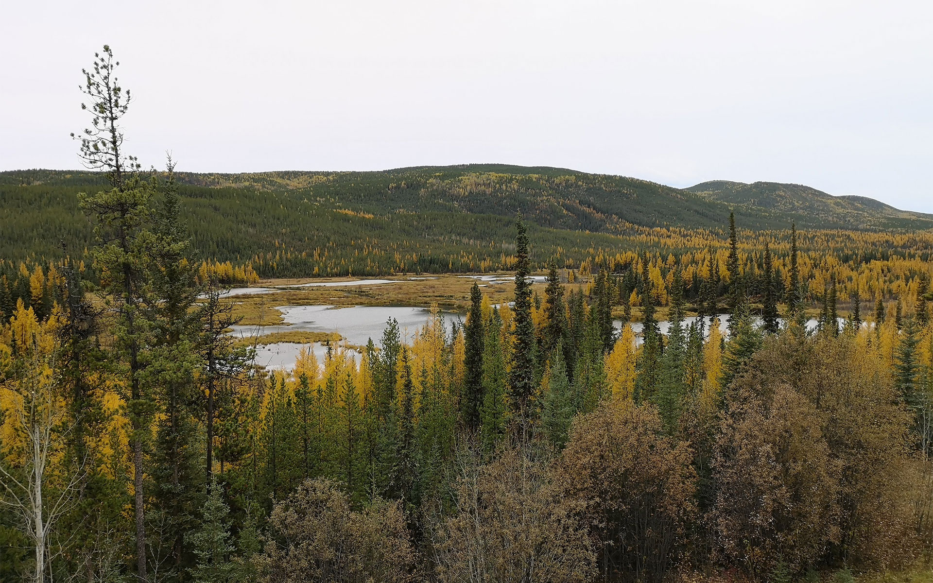
Nature-based climate solutions (NbCS) — strategies that harness the power of nature to boost natural ecosystems, provide habitat for wildlife, sequester carbon from the atmosphere and keep it stored in soils and plants — are essential to meeting Canada’s climate and biodiversity targets. A central tenet of NbCS is “protect what you have” — and Canada, compared to other nations, has a lot. One third of the planet’s remaining intact ecosystems are found here, nestled between three oceans and within Indigenous territories, including large swaths in the north.
As part of an international commitment — the High Ambition Coalition for Nature and People — Canada has set an ambitious goal, referred to as 30×30, to protect 30 per cent of its land and freshwater, as well as its oceans, by 2030. While quantitative targets are critical for measuring progress, the qualitative aspects of protected and conserved area establishment and management are equally important.
What’s lacking now in many conservation efforts is the fact that … it doesn’t represent the spirit of the animals, the spirit of the plants and all the interconnectedness that’s celebrated by Indigenous people and their relationships with place.
—Steven Nitah, Łutsël K’é Dene First Nation
To date, the establishment of protected areas have resulted in islands of conservation, at times without consideration for connectivity, ecological representation, the potential to store carbon, and the impact on the livelihood and disruption of Indigenous people. A plan for longstanding maintenance and stewardship of these lands — the burden of which disproportionately lands on Indigenous communities — has also often been overlooked.
A new approach is urgently needed if we are going to advance reconciliation and achieve our climate and biodiversity goals — one that protects the right areas, for the right reasons, in the right way.
The establishment of protected and conserved areas in the future must satisfy three key criteria:
The need to prioritize equitable and just conservation outcomes, and advance Indigenous rights, responsibilities, governance and economies, including through the establishment of Indigenous Protected and Conserved Areas (IPCAs), with full consent, participation and leadership of Indigenous communities that live within them.
The need to deliver climate change benefits by safeguarding carbon stocks (i.e., climate change mitigation) and building resiliency and connectivity (i.e., climate change adaptation).
The need to be beneficial for biodiversity, protecting vital habitat for species at risk and building a buffer for species to adapt to climate change.
A new protected area assessment by WWF-Canada, called Beyond targets: A pathway for protected areas to help meet biodiversity and climate goals in an ethical and rights-driven way, identifies areas of high conservation value that, if protected, can deliver effective nature-based climate solutions, help reverse wildlife loss and make progress toward our national greenhouse gas reduction goals. But it’s only one piece of the puzzle. The value of protected and conserved areas cannot be captured by metrics alone.
For that reason, we are presenting the findings of our study alongside the perspectives of four Indigenous leaders who share their expertise as caretakers of the land, and how IPCAs can be a pathway to reconciliation. Indigeneous governance and knowledge systems, built over millennia through a deep connection to the land, are essential to building a new model of global leadership for protected and conserved areas — one that creates a resilient and equitable future for all.
Indigenous Peoples have been managing lands and waters on their territories for thousands of years — they have a wealth of knowledge to continue to steward these lands in healthy and resilient ways. The practice of two-eyed seeing means learning to see and embrace the strengths of Indigenous knowledge from one eye, and the strengths of “Western” scientific knowledge from the other.
A protected areas network for climate and biodiversity
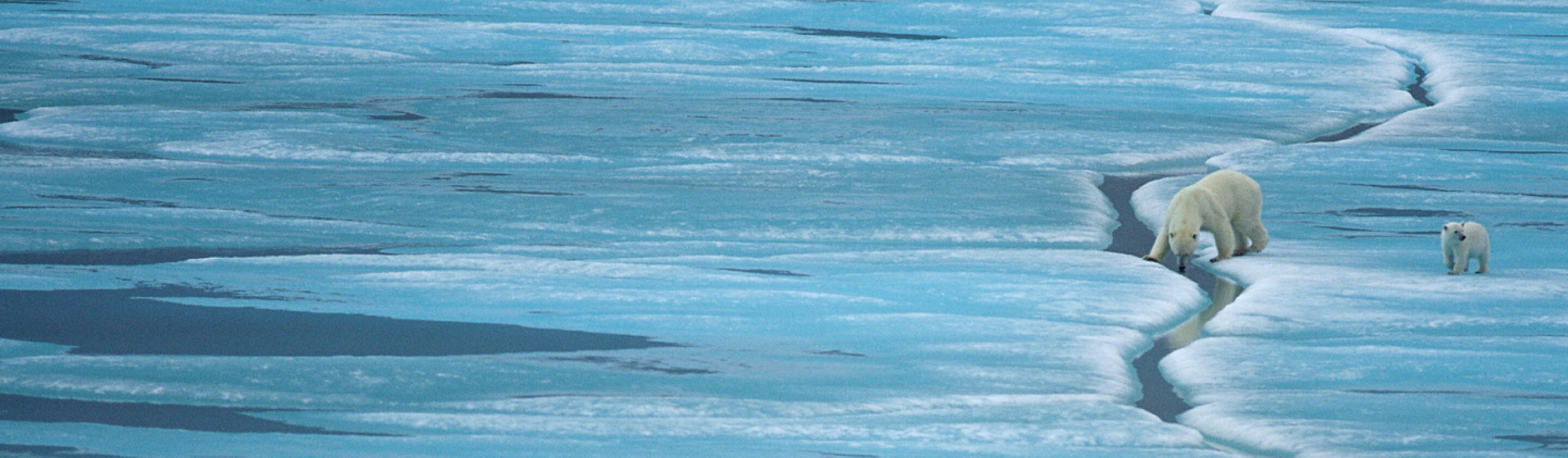
The impacts from climate change — changes in ice coverage, food-web dynamics, and vegetation — in Canada are also increasingly forcing wildlife to change how and where they live. That’s why it’s crucial that a protected areas network is forward looking, so that as climate change progresses, it will remain beneficial for wildlife by providing a range of habitats that are expected to remain relatively stable as well as allowing wildlife to relocate to new areas that are more suitable.
And since Canada stores at least 327 billion tonnes of carbon in its plants and soils, this network also needs to protect large carbon stocks from disruption to avoid the risk of releasing that carbon into the atmosphere, further accelerating climate change.
An effective protected areas network takes many factors into account, including:
Indigenous rights and title holders’ support
Where species at risk are located
The location of large carbon stocks that help mitigate climate change
Ecological connectivity, which allows wildlife to adapt to climate change by ensuring a diversity of habitats and corridors that allow them to move freely as the climate changes
Climate resiliency, which provides a buffer for climate adaptation.
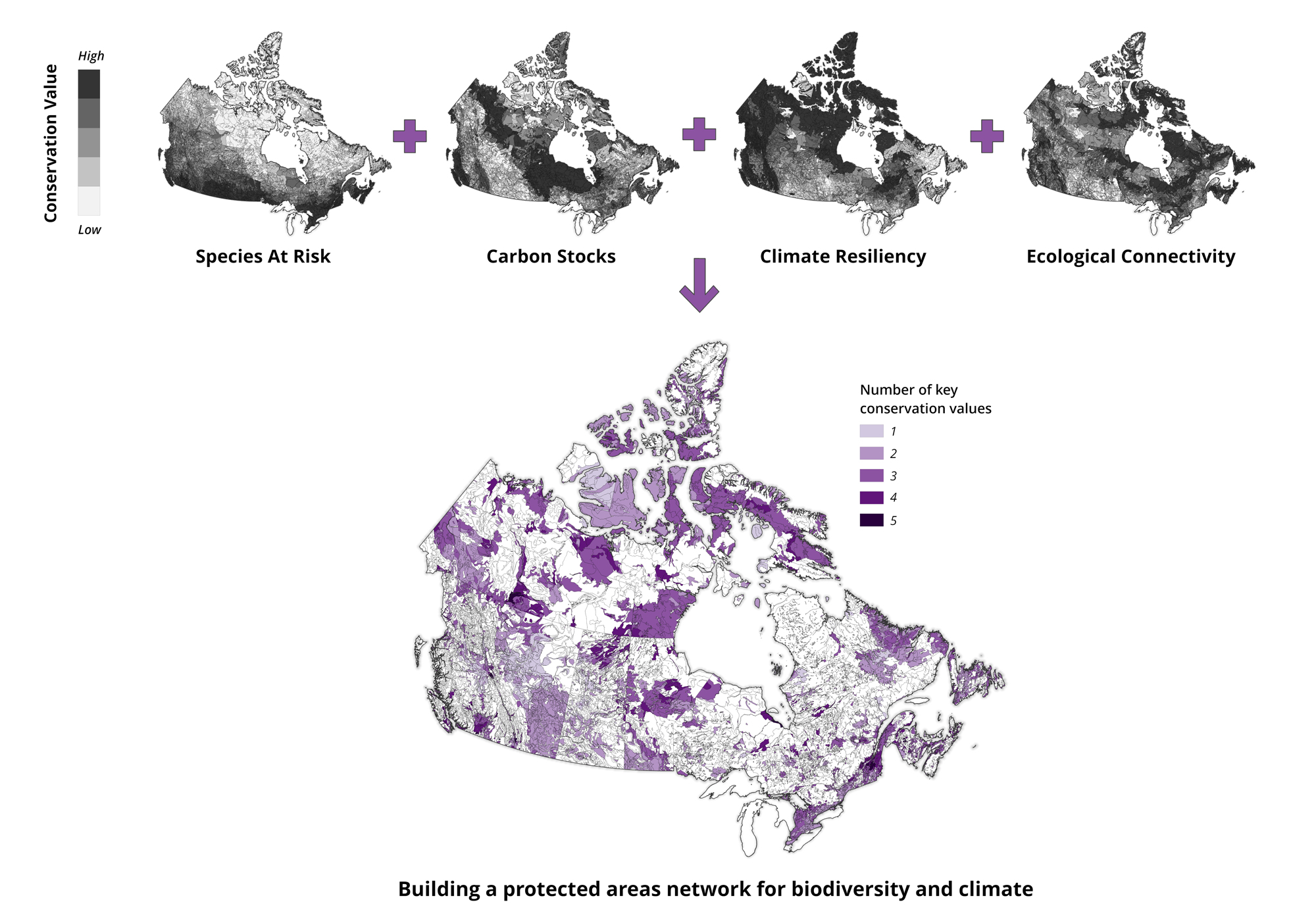
Our study conducted an analysis of ecological representation to identify gaps in our protected areas network (including considering whether existing protected areas were large, had good coverage, were connected to one another, and if the areas were intact and representative of diverse elevations and shorelines) and then layered on four of the above factors, for which there was available spatial data.
The result is a map that gets us one step closer to identifying areas that, if protected as part of Canada’s 30×30 goals, can help meet our carbon and biodiversity targets. Note, any region identified below as higher priority must still have Indigenous consent and support, and recognize the rights and title of the lands on which the actions are taken.
The conservation values map was created by overlaying the gaps found in the analysis of ecological representation with maps of species at risk, carbon stocks, climate resiliency and ecological connectivity.
All coloured areas have been identified as gaps in Canada’s protected areas network, and are therefore considered near-term priorities, with the colour gradient depicting the relative priority, dependent upon the number of overlapping key conservation values. Importantly, any IPCA should be given priority for protected status.
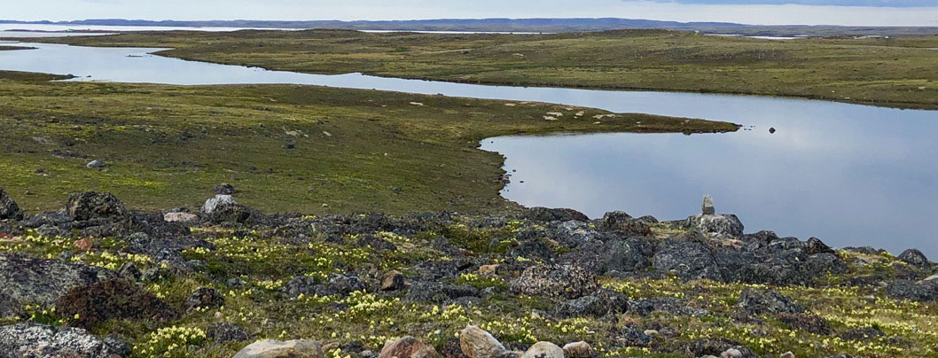
The map also revealed a stark contrast between the north (the territories, for the purpose of this study), and the south (the provinces). Large swaths of intact lands in the north have been stewarded by Indigenous communities for millennia, and are extremely important for climate resiliency. These areas face a disproportionate need for protection to ensure they can provide a critical haven for wildlife in the face of climate change. However, implicit in the geographic location of intact areas is the inequity of northern Indigenous Peoples in shouldering the burden of responsibility to achieving a protected areas network for both biodiversity and climate.
The south, by contrast, is dotted with small islands of remaining biodiversity that could be under high threat. Here, our analysis suggests the provinces will need to accompany protection with restoration to address the high human footprint in the region.
Prioritizing Indigenous Protected and Conserved Areas
Indigenous Protected and Conserved Areas are protected lands and waters where Indigenous Peoples have chosen to have the primary role in protecting and conserving ecosystems through Indigenous laws, governance and knowledge systems. They’re created and managed by Indigenous governments, varying by regional priorities, and help to enable local conservation economies.
Recent research has amplified the effective stewardship of biodiversity on Indigenous lands, where biodiversity on Indigenous-managed lands is higher than other protected areas in Canada. Implementing protected areas without the engagement and support of Indigenous communities, some of whom are already more vulnerable to the impacts of climate change, can lead to disruption of cultural and economic well-being, and other negative impacts.
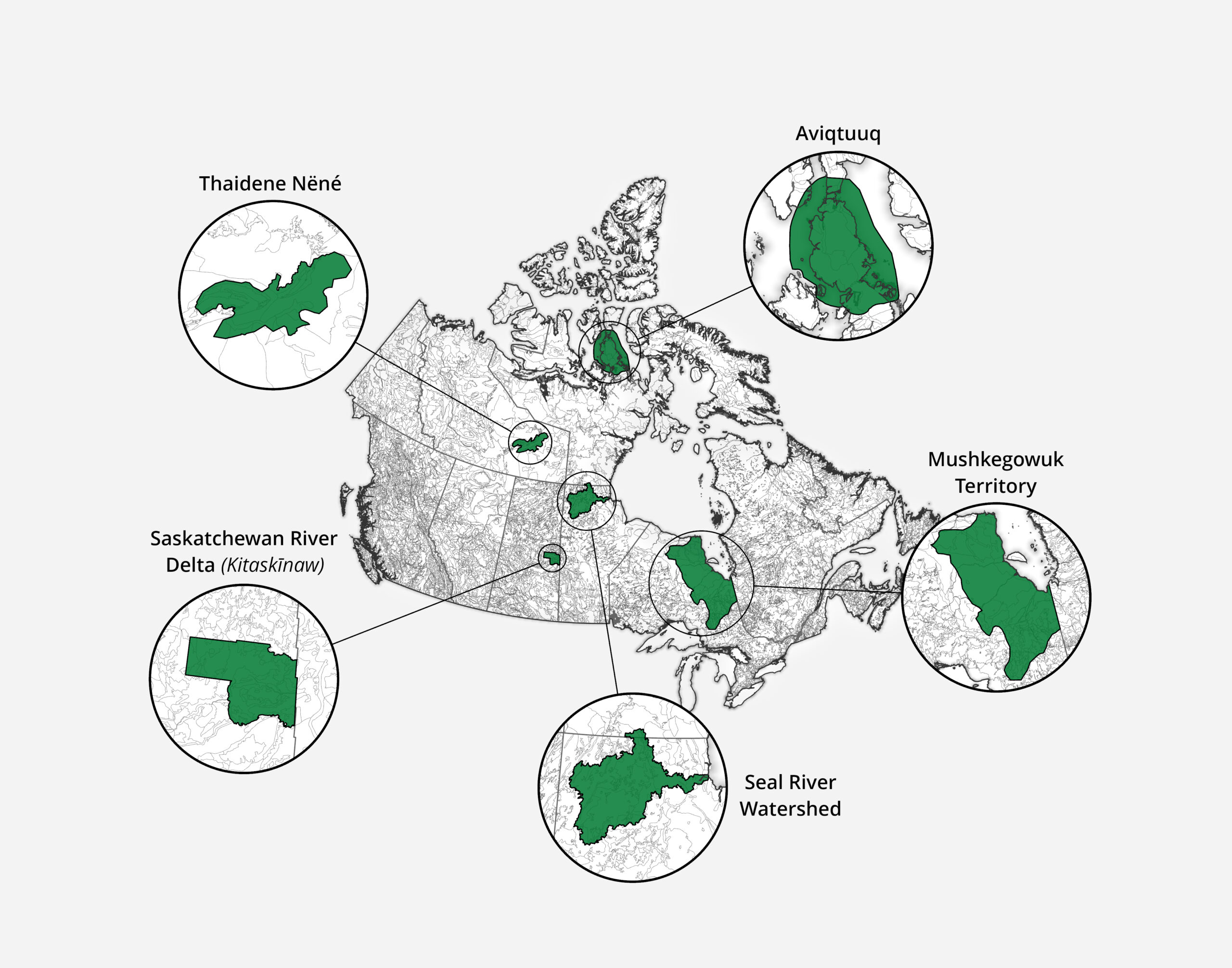
There are a growing number of Indigenous-led conservation efforts underway in Canada. The following section features leading examples across the country, including interviews with Indigenous conservation leaders who shared their expertise working to protect these important places.
Spotlight on Indigenous Protected and Conserved Areas
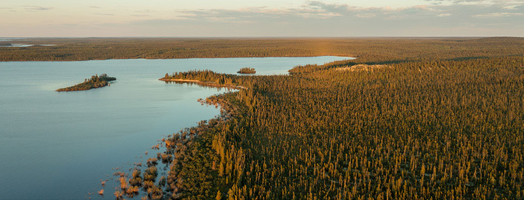
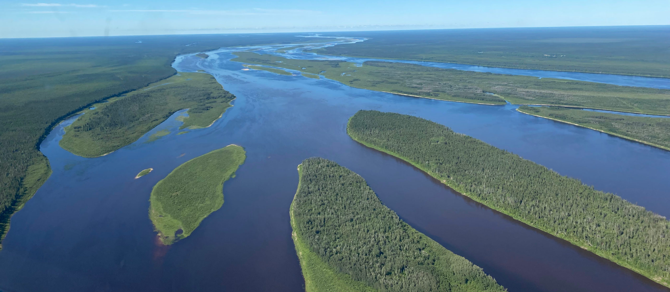
The Seal River Watershed, west of Churchill, Manitoba, is one of the world’s last remaining intact spaces. It’s a rare region devoid of roads, development or mines — where wildlife such as caribou and polar bears move freely throughout the vast 50,000km2 landscape. As the only community in the region, the Sayisi Dene First Nation calls the Seal River Watershed home and they are working toward the creation of an IPCA with the goal of protecting the watershed indefinitely. While being led by the Sayisi Dene First Nation, the initiative is supported through partnerships with their Cree and Dene neighbors. The Seal River Watershed has large carbon stocks and is particularly important for climate resiliency and ecological connectivity on a national scale.
Stephanie Thorassie, Executive Director, Seal River Watershed Alliance, Sayisi Dene First Nation
This area that we’re talking about protecting is traditional territory that’s shared with our neighbours to the west, south, and even a little bit to the north of us. It’s 50,000 square kilometres, and 99.97 per cent of it is pristine land. The eskers, the lakes, the trees, the water, the caribou — the Dene people are people of the caribou — every aspect of this watershed is essentially the same as it was when my great, great, great great-grandparents were here. This is the area we’re striving to protect for our children’s children’s children.
We work with four different communities and we’re really trying to bring all those voices to the table to make sure that we all have a say.
There is an incredible energy that comes from being connected to the land, but also to community members in the Seal River Watershed. When we continue to encourage these connections, amazing, incredible things can happen.
The Saskatchewan River Delta is a 9,706km2 inland water delta — the largest in North America — that contains wetlands, lakes, river channels and forests that provides vital habitat for wildlife such as muskrat and moose, while sequestering carbon from the atmosphere. The Delta has supported Indigenous peoples for over 7,000 years. But continued habitat degradation and biodiversity loss has affected the community’s way of life. In June 2021, the Cumberland House Cree Nation declared formal protection for the Kitaskīnaw under Indigenous law. The Saskatchewan River Delta stores over 949Mt of carbon in its plant biomass and soils up to one meter in depth.
Nadina Gardiner, Cumberland House Cree Nation
Right now, our delta is dying. There’s been such a change in flow as the Saskatchewan River has been dammed upstream. When you reverse or completely change the flow of a river, you’re not just changing the flow of that river, you’re changing the flow of all the animals and all the species and everything in there. We have been sounding the alarm about the Delta for years, since long before my time. This is such a significant area for nesting and migration for waterfowl, some of which travel all the way to South America. This doesn’t just affect us, it affects everybody. Even if you just consider the amount of carbon that these wetlands capture, you would see why it was so important to keep it healthy and to maintain, restore and rejuvenate it, so it becomes an area of carbon capture instead of emissions.
Thaidene Nëné — “Land of the Ancestors” in Dënesųłiné Yati — is an IPCA spanning more than 26,000 km2 in the Northwest Territories at the transition between the boreal forest and the tundra. It’s home to a variety of wildlife including grizzly bears, wolves and moose. It was designated as an IPCA in 2019 by the Łutsël K’é Dene First Nation under Dene Law. Through establishment agreements with Parks Canada and the Government of the Northwest Territories, the IPCA comprises a national park reserve (14,305km2), a territorial protected area (8,906km2) and a wildlife conservation area (3,165km2) — each with its own set of laws. The IPCA is co-managed by Indigenous and crown governments to conserve the natural and cultural heritage of the region.
Steven Nitah, Łutsël K’é Dene First Nation
Thaidene Nëné is in the heart of the Łutsël K’é Dene homeland and protected under our law. But that protection isn’t what you might think. The land will do what it wants and it’s our job not to over manage it. Where management on the ground is required, we utilize traditional Indigenous ecological knowledge and place-based knowledge combined with science of today. IPCAs represent a new relationship between Indigenous governments and the Crown. The mandate that was given was to implement the spirit of intent with which we entered the treaty — to share the land, the benefits of it and the responsibility for its management. Thaidene Nëné is a place we know we have to defend and fight to protect on a continuous basis. Protecting it is consistent with our way of life and will continue to provide us the opportunity to be Dene.
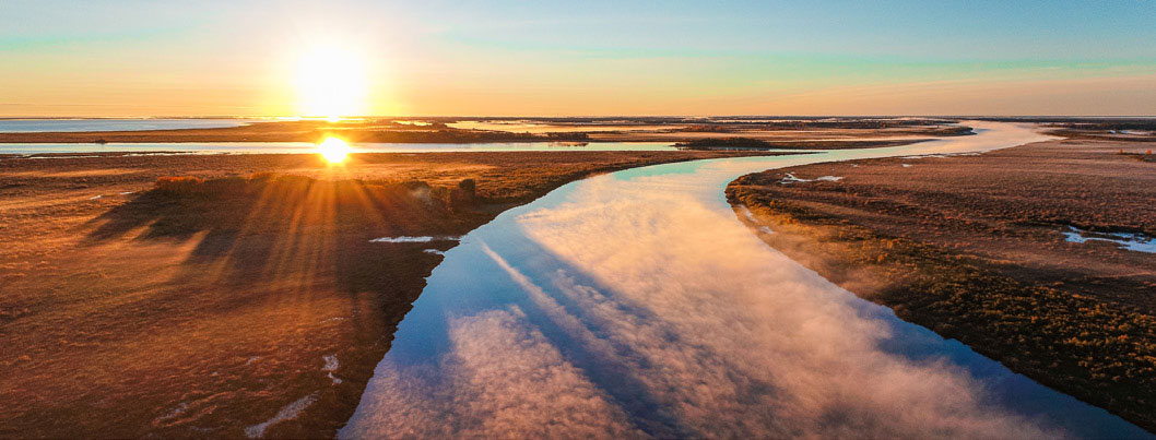
Taloyoak — the most northly community on the mainland in Canada — is working to establish an Inuit Protected and Conserved Area in their traditional lands of Aqviqtuuq. The proposed area would cover almost 90,000km2 of marine, terrestrial and freshwater ecosystems in Nunavut, helping safeguard caribou, polar bear, muskox and Arctic whales. The region is under threat from international shipping and mining, which also threaten the community’s food security and economic prosperity.
Taloyoak residents have proposed an Arctic Inspiration Prize-winning plan (Niqihaqut; meaning “our food”) to form the management of Aqviqtuuq. Through development of a conservation and food-based economy, the proposed Inuit Protected and Conserved Area can help to conserve nature’s bounty and support sustainable access to food and other resources for northern communities. In addition to all of these values, there are over 554Mt of carbon stored within the terrestrial and freshwater ecosystems of Aqviqtuuq, and the area is nationally important for ecological connectivity and climate resiliency.
Jimmy Ullikatalik, manager of Spence Bay HTA in Taloyoak, NU
Since my grandfather’s era, when there was talk of building a pipeline across Aqviqtuuq, we’ve fought to keep it safe. So, we’re working to create the Aqviqtuuq Inuit Protected and Conserved Area (IPCA). An IPCA is not like a regular protected area because it puts Indigenous people in charge, ensuring our food security with a sustainable harvest as well as economic development like small-scale fisheries, outfitting camps, and tourism.
Aqviqtuuq is our home, our traditional lands. It has provided us with what we have needed to survive and thrive here for generations. We want to see the lands and resources here protected from industrial development because the area is sacred to us, and has everything we need to prosper. A mine might create jobs for 20 years. But the first-ever Inuit Protected and Conserved Area in Canada would generate jobs forever, from generation to generation, and still protect the land.
Sweeping across northern Ontario and stretching into Manitoba and Quebec, the HJBL is home to many Indigenous communities, including seven Mushkegowuk First Nations, as well as lands and waters of extreme importance for national and global biodiversity and climate goals. Much of this rich ecology is due to Indigenous stewardship over thousands of years. The Hudson Plain ecozone, of which these lands are a part, has an area of 349,000 km² and stores 38 Pg of carbon in the first metre of soil. This is considerably more soil carbon per area than any other ecozone in Canada.
This puts the region rightly at the heart of discussions about large-scale protection for carbon-in-nature through globally significant peatlands, forests and coastal zones as well as for its concentrations of terrestrial and marine species, including wolverine, caribou, lynx and even polar bears in its most northern region. It’s also an important habitat for migratory birds, such as the palm warbler. Despite its importance, the area is under threat from development (a hotbed of mineral deposits known as the “Ring of Fire” is found in the area). Mushkegowuk Council Chiefs have called for a moratorium on the Ring of Fire until a proper protection plan is created for the area.
Vern Cheechoo, Mushkgeowuk Council’s Director of Lands & Resources
The Hudson and James Bay Lowlands are covered by peatlands which are an incredibly dense and globally significant carbon storage area. These carbon-rich areas are known as the ‘breathing lands’ to our Elders, and hold significant cultural value for the communities in the region.
The path toward a new model for protected areas in Canada
Protected area establishment in Canada cannot continue under a “business-as-usual” approach. The dual crises of biodiversity loss and climate change demand that new protected areas deal with both at the same, and our responsibility to advance reconciliation demands the prioritization of Indigenous rights and title. This is why we need a new model.
The new model should:
Consider connectivity, ecological representation, climate refuges, carbon storage and Indigenous rights and title, all while incorporating strategies for long-term management and stewardship.
Prioritize Indigenous Protected and Conserved Areas (IPCAs). Non-IPCAs should be co-developed and implemented with Indigenous consent, recognition of territorial rights and title, and incorporation of Indigenous knowledge systems, leadership and stewardship.
Establish and define emissions reduction targets for protected areas, and include them in the Government of Canada’s Naturally Determined Contributions (NDCs).
Create new financial tools that account for the establishment, management and long-term stewardship of protected areas so that they can provide prolonged benefits for biodiversity and climate in the centuries to come.
Develop new legislative tools to advance IPCAs where current protected areas establishment tools are limited — as identified by the Indigenous Circle of Experts during the Pathway to Target 1 process. Crown governments must also recognize and support IPCAs when unilaterally declared by Indigenous Nations in acknowledgment of self-determination and self-governance.